
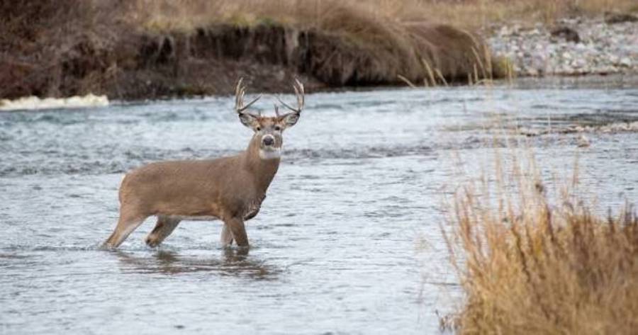
Yes, deer use creek beds and the surrounding creek corridors as travel routes, especially when these terrain features provide cover, connect bedding and feeding areas, or create an easier path through the landscape. Whitetail deer may walk directly through a dry creek bed, follow one side of a creek bottom, or cross the water at specific locations where the banks and surrounding terrain make movement easier. However, the presence of a creek alone does not mean deer will consistently travel along it.
Creek-bed use depends on several factors, including terrain, vegetation, water level, nearby bedding areas, food sources, and hunting pressure. A creek running through thick cover between bedding and feeding areas can function as a regular travel corridor, while an exposed creek with steep banks or no connection to important deer destinations may receive little use. Certain crossings can also concentrate movement when terrain limits where deer can comfortably move from one side to the other.
For hunters, the key is identifying where creek terrain influences predictable deer movement rather than simply hunting beside water. Tracks, established trails, creek crossings, rubs, scrapes, terrain funnels, and trail-camera activity can reveal whether deer are actively using a creek bed and which locations deserve closer scouting.
Do Deer Use Creek Beds for Travel?
Deer use creek beds as travel routes when the creek provides an efficient or secure path through the surrounding terrain. Whitetail deer may walk directly inside a dry or shallow creek bed, follow trails parallel to the creek, travel through the wider creek bottom, or cross the creek at established locations. The exact movement pattern depends more on terrain and cover than on the presence of water itself.
Creek beds become particularly relevant when they connect places deer already need to reach. A creek corridor located between a bedding area and a feeding area, for example, can provide a natural route between those two destinations. Deer may also encounter creek systems while moving between bedding areas, agricultural fields, mast-producing timber, staging areas, or other frequently used locations. In these situations, the creek becomes part of a larger travel network rather than the primary reason for the movement.
The surrounding topography determines how strongly a creek influences that travel. Steep slopes, bluffs, ridges, deep banks, and other terrain barriers can restrict the number of practical routes available to deer. When several possible routes converge near the same creek bottom or crossing, deer movement becomes concentrated into a smaller area. Conversely, a creek running through flat, open terrain may have little influence on travel if deer can move just as easily elsewhere.
Hunters should therefore avoid treating every creek bed as an automatic deer highway. A creek bed becomes valuable for hunting when current deer sign and surrounding terrain show that deer repeatedly use it as part of their travel pattern. Tracks, worn trails, repeated crossings, rubs, scrapes, and trail-camera observations provide stronger evidence than the creek feature alone.
Why Do Deer Use Creek Beds as Travel Routes?
Deer use creek beds and creek corridors primarily because these terrain features can provide cover, connect important destinations, create efficient routes, and funnel movement. These advantages vary from one property to another, which explains why one creek can contain heavily used deer trails while another nearby creek shows almost no consistent activity.
Cover is one important factor. Creek bottoms frequently support thicker vegetation than adjacent terrain because of differences in moisture, sunlight, and disturbance. Brush, grasses, young trees, and creek banks can reduce visibility around traveling deer. Where this vegetation creates security cover, deer can use the corridor to move while remaining less exposed than they would be crossing an open field or sparse timber. Thick creek cover can be especially relevant when the corridor extends toward bedding or feeding areas.
Creeks can also connect locations deer regularly visit. Deer movement is destination-driven, so the relationship between the creek and nearby bedding, feeding, and security cover is more important than the creek by itself. A creek bottom that runs from dense bedding cover toward an agricultural field, for example, has a stronger reason to carry travel than a creek that leads away from frequently used habitat. Hunters can evaluate this relationship on aerial and topographic maps before looking for physical evidence on the ground.
Terrain can further concentrate deer movement along a creek. A steep bank may prevent convenient crossing along most of the channel while leaving several low-bank locations accessible. Likewise, a creek positioned between a steep hillside and another terrain obstacle can narrow the amount of usable ground. These restrictions create funnels or pinch points where multiple travel options converge into a smaller corridor.
Deer do not necessarily remain inside the creek bed when using these systems. The functional travel corridor can include the creek channel, its banks, adjacent cover, and parallel trails running through the creek bottom. A hunter scouting only the water’s edge can therefore miss a heavily used trail located farther up the bank. Evaluating the entire creek corridor reveals how deer actually interact with the terrain and helps distinguish a productive travel route from a creek that merely looks promising on a map.
What Types of Creek Beds Do Deer Use Most Often?
Deer most often use creek beds that provide easy travel, security cover, useful connections between destinations, or terrain features that concentrate movement. Dry creek beds, shallow creeks, creek bottoms with thick vegetation, and channels bordered by restrictive terrain can all carry regular deer traffic. The most productive type depends on how the creek fits into the surrounding habitat rather than whether it contains flowing water.
Dry creek beds can function as natural travel corridors because deer can walk through the channel without entering water. A dry drainage may also create a lower, more concealed route through otherwise exposed terrain. Its hunting value increases when it connects bedding cover with feeding areas or intersects other established trails. A dry creek bed that leads nowhere important and contains little current sign should not be considered productive simply because its channel is easy to follow.
Creeks with shallow water can also carry deer movement, although deer may alternate between walking beside the channel and crossing it. Water does not automatically prevent travel. Instead, bank structure, water depth, current, surrounding cover, and alternative routes determine how deer interact with the creek. A shallow section with gradual banks is generally easier to cross than a section bordered by deep water and steep banks, so terrain can concentrate repeated crossings into specific locations.
Creek bottoms with thick cover deserve particular attention because the usable travel corridor can extend well beyond the creek channel. Deer may follow parallel trails through brush, grasses, young timber, or other vegetation while remaining close to the drainage. This means the most important trail may be several yards away from the water. Hunters should scout both sides of the creek and the surrounding bottom instead of assuming the channel itself contains the primary route.
Creeks bordered by steep terrain can create an even more defined movement pattern. The fewer practical routes the terrain provides, the more valuable individual trails and crossings can become. A steep bank, bluff, ridge, or sharp slope may discourage deer from moving through one section while a gradual bank or terrain break offers an easier route. These differences can create funnels that make deer movement more predictable.
For hunting purposes, creek beds should therefore be evaluated by function rather than appearance. A narrow drainage with no permanent water can be more important than a large flowing creek if the smaller drainage connects two heavily used areas and contains fresh deer sign. The best creek bed is the one that consistently fits the deer’s existing movement pattern.
Where Do Deer Usually Cross Creeks?
Deer usually cross creeks where the combination of bank access, water conditions, established travel routes, and surrounding terrain makes crossing practical. Shallow water and low banks can create obvious crossing opportunities, but the strongest locations are often those where an accessible crossing also aligns with a trail leading toward bedding, feeding, or other regularly used habitat.
Low or gradually sloping banks are important because they provide convenient entry and exit points. If a long section of creek has steep or deeply cut banks but one location contains gradual approaches on both sides, that location can concentrate movement. Hunters scouting such terrain should look beyond the water itself and identify where trails enter the creek on one bank and continue away from it on the opposite side.
Shallow sections can provide another clue. Deer are physically capable of crossing water, so the objective is not simply to locate a place where their feet remain dry. Instead, hunters should identify where favorable water depth coincides with the route deer already want to follow. A shallow section located away from cover and established trails may receive less traffic than a slightly more difficult crossing positioned directly between important destinations.
Existing trails provide stronger evidence than appearance alone. A creek crossing becomes more significant when a defined trail approaches the creek, crosses it, and continues on the opposite side. Fresh tracks in mud, disturbed leaves, repeated hoof impressions on the bank, and worn entry or exit points can confirm that the location is being used. Multiple trails converging near one crossing provide additional evidence that the creek is concentrating movement from a wider area.
Terrain funnels can make creek crossings particularly useful to hunters. For example, a creek may run against a steep hillside, forcing deer traveling through the bottom toward a narrow strip of usable ground. A drainage intersection, low bank, terrain saddle, or constriction between the creek and another obstacle can produce a similar effect. In each case, the crossing matters because the larger landscape directs deer toward it.
Hunters should also determine where deer go after crossing. Following trails away from the creek or examining aerial and topographic maps can reveal whether the route leads toward bedding cover, food, another drainage, or a larger travel corridor. The most useful creek crossings combine fresh deer sign with a logical destination on both sides of the water. This distinction prevents hunters from investing time in visually attractive crossings that are rarely part of consistent deer travel.
How Can You Tell If Deer Are Using a Creek Bed?
You can tell deer are using a creek bed by finding multiple signs of current travel, including fresh tracks, established trails, creek entry and exit points, rubs, scrapes, and repeated trail-camera activity. One sign can confirm that a deer passed through an area, but several types of sign concentrated along the same route provide stronger evidence that the creek is part of a consistent travel pattern.
The first objective is to determine whether deer are simply crossing the creek or traveling along the creek corridor. Tracks that enter on one bank and leave on the opposite bank indicate a crossing, while tracks and trails running parallel to the channel indicate travel along the drainage. Some creek systems contain both patterns. Deer may follow the bottom for part of their route before crossing at a low bank, trail intersection, or terrain funnel.
Freshness matters when evaluating these signs. Tracks in mud or soft creek-bottom soil can reveal hoof shape, direction of travel, and repeated use, but old tracks do not necessarily represent current movement. Recently disturbed leaves, fresh tracks over older tracks, newly exposed soil on a bank, and active trails provide better evidence. Hunters should compare several locations along the creek instead of assuming the first track they find identifies the primary travel route.
What Deer Signs Should You Look for Along a Creek?
The most useful deer signs along a creek are tracks, defined trails, worn crossings, rubs, scrapes, and evidence that several travel routes converge in the same area. These signs serve different purposes. Tracks establish recent presence, trails reveal repeated movement, and crossings show where deer interact with the creek itself.
A defined trail is particularly useful because repeated travel gradually creates a visible route through vegetation, leaves, or soft ground. Hunters should follow the trail far enough to understand its direction rather than evaluating only the portion beside the creek. A trail that continues toward thick bedding cover, a feeding area, or another major travel corridor provides more context than an isolated trail that disappears shortly after leaving the creek.
Tracks can add information about how deer use the route. Several sets of tracks traveling in the same general direction can indicate repeated movement, while tracks approaching from different directions may identify an intersection. Mud, sand, and exposed soil near creek banks often preserve tracks more clearly than harder ground elsewhere in the woods, making crossings useful locations for evaluating recent activity.
Rubs and scrapes can provide additional context, particularly when they occur beside an established travel route. A rub line following the same creek corridor or a scrape positioned near a trail intersection can strengthen the case that deer regularly move through the area. However, rubs and scrapes should be interpreted together with trails, tracks, terrain, and current activity rather than treated as proof that a specific location receives predictable movement every day.
Hunters should also inspect both sides of the creek. The strongest trail may run parallel to the water on one bank before crossing farther downstream. In a broad creek bottom, several secondary trails may eventually converge into one primary route. Scouting the entire corridor helps identify this convergence and prevents the hunter from focusing on an isolated piece of sign.
Where Should You Place a Trail Camera Along a Creek?
Place a trail camera where the creek concentrates deer into a predictable route, such as an established crossing, converging trail intersection, low-bank entry point, or terrain funnel. These locations are more useful than placing a camera randomly beside the water because they monitor a specific movement pattern that can be evaluated over time.
An established crossing is a logical starting point when fresh tracks and trails appear on both sides of the creek. Position the camera to capture deer approaching or leaving the crossing rather than only the small area where they enter the water. This wider view can reveal direction of travel and help determine whether deer are following the creek, crossing it, or using multiple nearby routes.
Trail intersections are another valuable camera location. When two or more trails converge before reaching a creek, a single camera can monitor movement coming from several directions. Repeated observations can then show which trail receives the most use and whether movement is associated with a particular direction or period.
Camera data is most useful when it answers a hunting question. Instead of using a trail camera only to determine whether deer exist in the area, use it to determine which creek route they use, which direction they travel, and whether the movement occurs during relevant hunting hours. These observations can help distinguish an active travel corridor from a location containing abundant sign but little current movement.
A trail camera should also be accessed without unnecessarily disturbing the route being monitored. Repeatedly walking through the crossing or along the primary deer trail can add human scent and disturbance to the exact location being evaluated. Where the terrain allows it, approach the camera from a route that minimizes contact with the creek travel corridor.
The strongest evidence comes from combining camera observations with physical sign and terrain. Fresh tracks confirm recent presence, established trails show repeated use, terrain explains why movement occurs there, and trail-camera observations reveal when deer are using the route. Together, these signals provide a more reliable basis for deciding whether a creek bed deserves further scouting or a hunting setup.
When Do Deer Use Creek Beds the Most?
Deer use creek beds most consistently when the corridor provides secure cover and connects areas they already need to reach, such as bedding and feeding areas. The amount of movement can change throughout the day and hunting season because food availability, breeding behavior, cover, human disturbance, and hunting pressure alter where and when deer travel. Hunters should therefore evaluate a creek as part of the surrounding habitat rather than expect the same movement pattern throughout the season.
Creek corridors located close to bedding cover can carry movement as deer leave or return to their beds. A creek that connects bedding cover with a feeding area may function as part of an evening or morning travel route. However, the most visible creek trail does not necessarily produce daylight activity. A route located far from bedding cover may receive substantial movement after dark, while a concealed route closer to a bedding area may provide a better opportunity to encounter deer during legal hunting hours.
Cover influences when deer are willing to use a creek corridor. Thick vegetation, steep banks, brush, and other visual barriers can provide a more concealed route than open terrain nearby. This security can make a creek bottom more useful for daylight travel, particularly when the corridor allows deer to move between important habitat areas without crossing large openings. An exposed creek running through open ground provides less of this advantage.
Hunting pressure can also change creek travel patterns. Deer may shift toward routes that provide more security when repeated human activity makes exposed or frequently disturbed routes less attractive. A brushy drainage or creek bottom can provide concealed movement through an area where surrounding trails receive greater disturbance. This does not mean hunting pressure automatically pushes deer into every creek bottom; the drainage still needs to connect useful habitat and provide a practical travel route.
Seasonal changes can alter the importance of individual creek routes as well. Changes in available food can shift feeding destinations, while breeding activity can change how bucks travel through an area. Hunting activity adds another variable as the season progresses. A creek trail that receives strong use during one portion of the season can become less important when the destinations at either end of the route change.
For this reason, hunters should prioritize current evidence over assumptions based on previous seasons. Fresh tracks, newly used trails, active scrapes or rubs where relevant, and recent trail-camera observations provide a clearer picture of present movement. The best time to hunt a creek travel route is when current deer activity, a useful destination, and favorable hunting conditions overlap.
How Does Water Level Affect Deer Travel in Creek Beds?
Water level affects whether deer travel inside a creek bed, along its banks, or across it at specific locations. Dry and low-water conditions generally provide more usable ground within the channel, while higher water can restrict convenient travel and increase the importance of accessible crossings. The effect depends on the size of the creek, bank structure, current, surrounding terrain, and availability of alternative routes.
A dry creek bed allows deer to move through the channel without entering water. When the drainage has gradual terrain and sufficient cover, the channel itself can become part of an established trail. Hunters can identify this pattern through tracks running lengthwise through the creek bed rather than simply entering and leaving it. Dry drainages can therefore function as travel corridors even though they contain no permanent water.
Low-water conditions create additional movement options. Deer may walk along exposed portions of the channel, use trails beside the water, or cross at several accessible locations. This can spread movement across a wider section of the creek if numerous crossings are equally practical. Hunters should look for repeated tracks and worn banks to determine which locations deer actually favor instead of assuming every shallow section receives equal use.
Higher water can change that pattern by making some portions of the creek less convenient to cross or travel through. When fewer practical crossings remain, deer movement can become concentrated at locations with favorable banks and manageable water conditions. A low bank, natural opening, established trail, or other accessible point may become more significant when adjacent sections are harder to negotiate.
Changes in water level can also make old deer sign misleading. A crossing used heavily during low water may become less attractive after substantial rainfall changes the depth or current. Deer can respond by shifting upstream or downstream to another crossing, following the bank farther before crossing, or using an alternative route through the surrounding terrain. Hunters who rely only on an established trail without checking current conditions can therefore monitor or hunt a route that deer have temporarily changed.
The practical approach is to evaluate water conditions together with terrain and fresh sign. Water level changes the available routes, while tracks, trails, and camera activity reveal which of those routes deer are currently selecting. After significant changes in creek conditions, rechecking known crossings and nearby alternatives can show whether movement remains concentrated in the same location or has shifted elsewhere along the corridor.
Are Creek Beds Good Places to Hunt Deer?
Creek beds can be good places to hunt deer when they concentrate consistent deer movement and allow the hunter to set up without disrupting the travel route. The presence of water or a creek channel alone does not make a location productive. A strong creek setup combines an active deer trail, favorable terrain, nearby bedding or feeding destinations, fresh sign, and an access route that minimizes disturbance.
The best creek locations often occur where the terrain reduces the number of routes available to deer. A steep bank, hillside, drainage intersection, narrow creek bottom, or other terrain restriction can push movement through a smaller area. These locations become more valuable when multiple trails converge near the same crossing or when the creek creates a natural connection between two important habitat areas.
Current deer sign should confirm what the terrain suggests. A crossing with fresh tracks on both banks, a defined trail continuing away from the creek, and repeated trail-camera activity provides stronger evidence than an attractive terrain feature with no recent activity. Hunters should use terrain to predict deer movement and fresh sign to verify that prediction. This approach reduces the risk of choosing a stand location based solely on how promising a creek looks on an aerial or topographic map.
The relationship between a creek and nearby destinations also determines hunting value. A heavily used creek trail that connects bedding cover to a feeding area has a clear function within the deer’s daily movement. Another trail may connect two sections of security cover or intersect a larger travel corridor. Understanding that function helps a hunter predict direction of travel rather than simply knowing that deer pass through the area.
A creek bottom can still be a poor hunting location even when deer use it regularly. Difficult access, unpredictable scent movement, limited visibility, or a setup that requires walking across the primary deer trail can reduce its effectiveness. The objective is therefore not to hunt directly beside every productive creek route. It is to find a position where the hunter can intercept that movement under suitable conditions without alerting deer before the encounter occurs.
Where Should You Set Up Near a Deer Creek Crossing?
Set up near a deer creek crossing where you can cover the primary travel route while keeping your scent, access route, and physical presence away from approaching deer. The exact distance from the water is less important than the relationship between the setup and the trail deer use before and after crossing.
Start by identifying the direction of travel. A creek crossing becomes easier to hunt when the trail on each side reveals where deer are coming from and where they are going. For example, a trail leaving dense bedding cover and crossing a creek toward a feeding area provides a more understandable movement pattern than an isolated set of tracks at the water’s edge. Following the trail away from the crossing and studying the surrounding terrain can reveal this larger pattern.
A setup does not need to be directly over the crossing. In some situations, the better position is along an approach trail where deer movement is concentrated before reaching the water. In others, a trail intersection or terrain pinch point beyond the crossing provides a more favorable location. The best setup covers predictable movement while reducing the chance that deer encounter the hunter’s scent or access route before reaching the shooting area.
Hunter access should be evaluated before selecting the final position. Walking down the primary creek trail, crossing an active bedding-to-feeding route, or repeatedly passing through the crossing can disturb the exact movement the hunter intends to target. An access route that uses the opposite side of a ridge, an unused portion of the drainage, or another terrain feature can reduce contact with active deer trails where the property allows it.
Entry and exit conditions also matter. A location may provide an excellent opportunity during the hunt but require the hunter to leave through an area where deer are expected to travel later. This can increase disturbance across repeated hunts. Evaluating the complete route from parking or property access to the hunting location helps determine whether the creek crossing is practically huntable, not merely whether deer use it.
Finally, hunters should avoid assuming that the most heavily worn crossing automatically provides the best stand location. Heavy nighttime activity, unfavorable wind conditions, poor access, or excessive proximity to bedding cover can make another part of the same travel corridor more practical. A productive creek setup requires both predictable deer movement and a way to hunt that movement without consistently alerting the deer using it.
How Do Wind and Thermals Affect Hunting Along Creek Beds?
Wind and thermals can make creek beds difficult to hunt because changes in elevation, vegetation, and surrounding terrain can alter scent movement within the creek bottom. A creek may contain an excellent deer travel route, but that route has limited hunting value if the hunter’s scent consistently reaches deer before they enter the effective hunting area.
Creek bottoms can create more complicated wind conditions than open, level terrain. The main wind direction above the creek does not always describe what happens inside a protected drainage. Banks, hillsides, vegetation, bends in the creek, and intersecting drainages can redirect air movement locally. A hunter may therefore experience a wind direction at stand height that differs from the forecasted wind across the surrounding landscape.
Thermals add another variable because air movement changes as the ground warms and cools. Warming air generally rises, while cooling air generally sinks, so elevation differences around creek bottoms can influence where scent travels. This becomes important when deer use trails at different elevations along the creek. A setup that keeps scent away from a trail under one set of conditions may become less reliable as temperatures and air movement change.
Creek-bottom setups should therefore be evaluated at the specific hunting location rather than solely from a weather forecast. Hunters can observe wind behavior from several positions around the creek to determine whether air consistently follows the expected direction or shifts within the drainage. Checking conditions at the intended hunting height and along the deer approach route provides more useful information than checking wind only at a parking area or on higher ground.
The expected direction of deer travel should be considered at the same time. If deer are likely to approach from bedding cover, the setup needs to prevent scent from entering that approach route before the deer reaches the hunting area. The same principle applies to a crossing used by deer traveling toward food. A favorable wind is one that keeps the hunter’s scent away from the expected deer approach and primary travel corridor, not simply one that blows away from the creek.
Wind behavior also affects access. A hunter can choose a stand with acceptable wind conditions but still contaminate the route while entering if scent blows across the creek crossing or bedding-side trail. Entry and exit routes should therefore be planned using the same wind considerations as the actual hunting position.
Repeated observation is valuable because individual creek systems behave differently. A deep, narrow drainage can produce different local air movement than a broad creek bottom, and dense vegetation can further affect conditions near the ground. Hunters who identify a productive creek route should determine which wind and temperature conditions allow that location to be hunted with the lowest risk of scent reaching traveling deer.
Ultimately, deer sign identifies where a creek should be considered, while wind, thermals, and access determine whether that location can be hunted effectively. When scent conditions are consistently unfavorable at the crossing itself, moving the setup farther along the same travel corridor can preserve access to the deer movement without forcing a poor position.
Read more: Do Deer Migrate in Winter? What Hunters Should Know
How Should You Scout a Creek Bed for Deer?
Scout a creek bed for deer by identifying likely travel routes on a map, locating potential crossings, checking fresh deer sign, determining direction of travel, verifying current use, and evaluating whether the route can be hunted without excessive disturbance. The goal is not simply to find deer tracks beside water. It is to determine how the creek fits into the larger movement pattern between bedding areas, feeding areas, security cover, and other destinations.
Start with aerial and topographic maps before walking the creek. Identify where the drainage passes near thick cover, bedding habitat, agricultural fields, mast-producing timber, ridges, draws, or other features that can influence deer movement. Then look for places where the surrounding terrain narrows the available travel space. Creek bends, steep banks, drainage intersections, narrow bottoms, and points where a hillside approaches the creek can create potential funnels.
Next, identify likely creek crossings. Prioritize locations where accessible banks and surrounding terrain align with a logical deer travel route. Low banks and shallow sections deserve attention, but they become considerably more useful when an established trail approaches the creek and continues on the opposite side. A convenient crossing with no connecting trail provides less evidence of consistent deer movement.
Inspect the ground for fresh sign after identifying these locations. Tracks in mud, sand, or exposed soil can show whether deer recently passed through the creek and which direction they traveled. Established trails, worn banks, disturbed vegetation, rubs, and scrapes can provide additional context. Hunters should compare several locations along the drainage because one crossing may carry substantially more movement than another.
Follow important trails away from the creek when access and property boundaries allow it. A trail becomes more useful once its function is understood. Determine whether it leads toward bedding cover, feeding habitat, another drainage, a ridge, or a larger trail network. Knowing where deer are traveling is more valuable than simply knowing that deer crossed the creek. This information also helps predict whether a route is likely to carry morning, evening, or primarily nighttime movement.
Trail cameras can then verify current use. Position cameras at high-confidence crossings, trail intersections, or funnels rather than distributing them randomly along the creek. Camera observations should answer specific questions: which direction are deer traveling, how frequently is the route used, and when does movement occur? Several observations of deer following the same route provide stronger hunting information than a single photograph from an isolated crossing.
After confirming movement, evaluate wind and access before selecting a hunting location. Determine how you can reach the area without walking through the primary trail, crossing likely bedding-to-feeding movement, or repeatedly disturbing the creek bottom. Check how wind behaves at the actual setup because conditions inside a drainage can differ from those on surrounding higher ground.
Finally, rank potential locations according to the complete evidence rather than one attractive feature. A high-value creek location combines current deer sign, predictable travel direction, terrain that concentrates movement, relevant nearby destinations, manageable wind, and low-impact hunter access. A location missing several of these elements should generally receive less attention even if it contains obvious tracks.
This scouting process turns a creek from a general terrain feature into a testable deer-movement hypothesis: maps predict where deer should travel, ground sign shows where they have traveled, trail cameras verify current movement, and wind and access determine whether that movement can be hunted effectively.
What Mistakes Should Hunters Avoid When Hunting Creek Beds?
Hunters should avoid assuming every creek is a deer travel corridor, relying on old sign, ignoring the destination behind the movement, overlooking alternative crossings, and choosing a setup without accounting for wind and access. These mistakes can make an active-looking creek less productive than expected because deer presence alone does not establish a predictable, huntable travel pattern.
The first mistake is treating the creek itself as sufficient evidence. Water, steep banks, and thick vegetation can make a location look promising, but deer need a reason to travel through it. A creek that does not connect useful habitat or influence surrounding movement may receive only occasional traffic. Confirm the route with fresh tracks, established trails, terrain relationships, or repeated camera observations before committing substantial hunting time.
The second mistake is relying on old sign. A heavily worn trail proves repeated historical use, but food availability, seasonal behavior, water conditions, and hunting pressure can change movement. Fresh tracks and recent camera activity provide better evidence of current use. This distinction becomes especially important after major changes in water level or habitat conditions.
The third mistake is finding a crossing without determining where the trail leads. A creek crossing is only one point within a larger deer travel route. Following the route conceptually on maps and physically where appropriate can reveal whether deer are moving toward bedding cover, feeding habitat, another travel corridor, or an area with little relevance to the hunting setup. Direction and destination give the crossing its hunting context.
Another mistake is focusing exclusively on the most obvious crossing. Deer may have several options along the same creek, and their preferred route can change when water conditions, cover, food sources, or disturbance change. Scouting upstream and downstream can reveal secondary crossings that become important under different conditions.
Poor access can also undermine a strong location. Walking along the primary deer trail, crossing the creek at the same point deer use, or approaching through bedding cover can introduce disturbance before the hunt begins. A slightly less concentrated travel route with cleaner access can sometimes provide a more practical setup than the strongest crossing on the property.
Finally, hunters should not select a creek-bottom setup without evaluating scent movement. A productive deer corridor is not automatically a productive stand location. Wind and thermals can make certain positions difficult to hunt without alerting approaching deer. When the crossing itself creates unfavorable scent conditions, moving along the same travel route to a more controllable position can provide a better hunting opportunity.
Creek beds are most useful when hunters evaluate them as components of a complete movement system. Terrain predicts where movement can concentrate, destinations explain why deer travel there, fresh sign confirms current use, and wind and access determine whether the route can be hunted effectively.