
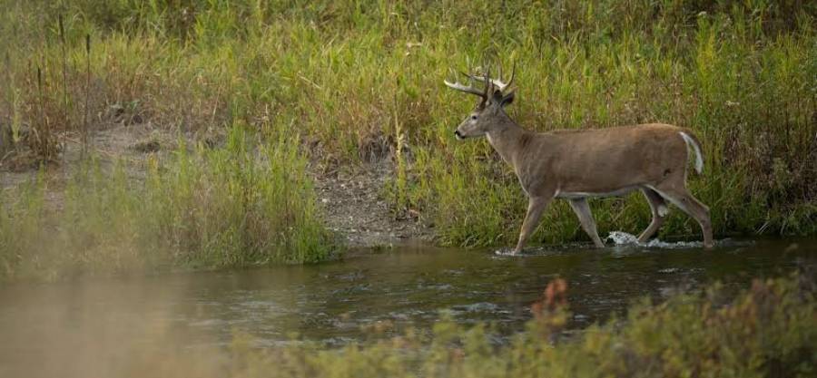
Beaver ponds can create productive deer hunting locations because water, flooded timber, creek channels, and narrow strips of dry ground can concentrate deer movement into predictable travel routes. The key to hunting deer around a beaver pond is identifying where the terrain forces or encourages deer to travel, then setting up where you can intercept that movement without exposing your scent or access route.
Deer do not use every part of a beaver pond equally. Established trails along pond edges, muddy crossings, beaver dams, creek banks, and narrow corridors between wet areas can reveal where deer repeatedly move between bedding cover and feeding areas. The best-looking location on a map is not automatically the best hunting location; fresh tracks, worn trails, droppings, rubs, scrapes, and repeated crossings should confirm that deer are currently using the area.
A successful beaver pond strategy therefore depends on more than finding water. Hunters need to understand how the pond affects deer travel, identify the most active funnels, evaluate wind direction, plan low-impact entry and exit routes, and adjust their setup as seasonal movement and hunting pressure change. This guide explains how to combine those factors to choose more effective deer hunting setups around beaver ponds.
Why Are Beaver Ponds Good Places to Hunt Deer?
Beaver ponds can be productive deer hunting areas because water and flooded terrain reduce the number of easy travel routes available to deer. Instead of moving freely through every part of the landscape, deer often have to travel around deep water, dense flooded timber, steep creek banks, or soft ground. These obstacles can concentrate movement onto dry pond edges, established trails, narrow strips of land, creek crossings, and other routes that provide easier footing.
There are 4 main terrain features that can make a beaver pond valuable for deer hunting: water barriers, dry-ground corridors, habitat edges, and crossings. Water barriers restrict movement. Dry-ground corridors give deer practical routes around those barriers. Habitat edges connect wet cover with timber, brush, or nearby feeding areas. Crossings such as shallow creeks or usable sections of a beaver dam can connect habitat on opposite sides of the wet area. When several of these features occur close together, deer movement can become easier to predict than it is in uniform timber.
The pond edge is especially useful because it creates a distinct transition between wet habitat and usable ground. Deer traveling between bedding and feeding areas may follow this transition rather than enter flooded terrain. For example, a pond bordered by thick cover on one side and a hardwood ridge on the other may leave only a narrow band of dry ground between the two. If fresh tracks and a worn trail appear on that band, the terrain and deer sign are supporting the same travel pattern.
Beaver activity can also change a hunting area over time. A newly flooded creek bottom may eliminate trails that deer previously used and redirect movement toward higher ground. A pond that loses water may expose additional crossings and dry routes. For that reason, a location that was productive in a previous season should not automatically be treated as productive now. Current water levels and fresh deer sign are more useful than old assumptions about how deer once traveled through the area.
Not every beaver pond is a good deer hunting location. A pond becomes valuable when its terrain concentrates deer movement and current sign confirms that deer are using those routes. An obvious dam, narrow bank, or attractive map feature has limited hunting value when there are no fresh tracks, trails, droppings, rubs, scrapes, or other evidence of repeated deer activity. Terrain identifies where movement is likely; deer sign confirms where movement is actually occurring.
How Do Beaver Ponds Change the Way Deer Travel?
Beaver ponds change deer travel by creating physical barriers that redirect movement toward easier routes around or across the wet area. Deer can move through shallow water, but they do not need to cross every flooded area they encounter. When a dry route provides easier movement between two useful parts of their range, that route can become a recurring travel corridor.
Water is the first mechanism that changes movement. A wide pond, flooded creek bottom, or section of submerged timber removes some direct routes through the landscape. Deer approaching the obstacle must move around it, cross it, or use a narrow section where passage is easier. This can create a funnel when multiple travel options converge on the same strip of usable ground.
Dry ground is the second mechanism. Narrow benches, ridges, strips of timber, and firm banks beside a pond can connect larger areas of suitable habitat. A dry strip between a beaver pond and a steep hillside is one example. Deer traveling through that area have fewer comfortable options than deer moving through open hardwoods, so an established trail on the strip may receive repeated use.
Beaver dams can also influence deer movement when they provide a practical connection across a creek or wet bottom. A dam should be treated as a potential crossing, not an automatic deer crossing. Some dams are too unstable, exposed, obstructed, or poorly positioned to become important travel routes. A hunter should look for repeated tracks, packed vegetation, muddy entry and exit points, or a continuing trail on both sides before considering the dam part of a reliable deer movement pattern.
Pond edges create another travel option because they often form continuous habitat boundaries. Deer can follow the edge while remaining close to cover and avoiding deeper water. The value of an edge increases when it connects destinations such as bedding cover, feeding habitat, a creek crossing, or another secure travel corridor. A long pond edge with no connection to other useful habitat may receive less deer traffic than a shorter edge positioned directly between bedding and feeding areas.
The strongest movement patterns often occur where several terrain constraints overlap. For example, a beaver pond on one side of a travel corridor and a creek, steep slope, or second wet area on the other can leave a narrow passage of dry ground between them. That passage functions as a pinch point because deer have fewer practical routes through the surrounding terrain. Fresh tracks and an established trail through the gap make the location substantially more meaningful than terrain appearance alone.
Hunters should therefore read a beaver pond as part of the larger landscape rather than as an isolated water feature. The important question is not simply whether deer visit the pond. The more useful question is how the pond changes the route deer use to move between bedding, feeding, cover, and neighboring habitat. Once that movement pattern is identified, the next step is to determine whether current deer sign confirms regular use.
What Deer Sign Should You Look for Around a Beaver Pond?
The 6 most useful deer signs around a beaver pond are established trails, tracks, droppings, rubs, scrapes, and repeated crossings. These signs help confirm whether a terrain feature that looks promising actually receives regular deer traffic. The strongest locations usually combine a terrain advantage, such as a narrow strip of dry ground, with multiple types of fresh sign pointing to repeated use.
Established trails provide the clearest indication of habitual movement. A primary trail is normally wider, more defined, and easier to follow than surrounding paths. Around beaver ponds, these trails may parallel the water, connect higher ground on opposite sides of a wet area, or pass through a narrow gap between the pond and another obstacle. A trail becomes more valuable when it continues toward bedding cover, feeding habitat, a creek crossing, or another travel corridor rather than ending near the water.
Tracks help determine whether a trail is currently active. Muddy pond margins, creek banks, exposed soil, and damp areas near dams often preserve tracks better than dry forest floors. Multiple fresh tracks traveling through the same entry and exit points provide stronger evidence than a single isolated track. Track direction can also help reveal how deer approach a crossing and where they continue after passing it, which matters when evaluating possible setup locations.
Droppings provide additional confirmation that deer are spending time in the area rather than merely passing through once. Fresh droppings near a trail, staging area, or edge transition strengthen the case that the location is being used currently. However, droppings alone do not reveal a precise travel route. Their value increases when they occur alongside tracks and an established trail.
Rubs can identify areas used by bucks, particularly when several rubs follow the same travel corridor. A single rub near a beaver pond does not automatically make the location productive. A line of fresh rubs running along a dry edge, narrow ridge, or trail between two habitat areas provides more useful information because the pattern can indicate repeated movement through the corridor.
Scrapes can add another layer of seasonal information. Active scrapes located near established trails may indicate that deer are using the corridor during the pre-rut or rut. Their hunting value depends on location and freshness. A scrape positioned beside a heavily used travel route has more context than an isolated scrape with no supporting tracks or trails.
Repeated crossings are especially important around water. A muddy entrance on one side of a creek, corresponding tracks on the opposite bank, and a continuing trail through the timber provide a complete movement pattern. The objective is to identify connected sign rather than collect individual observations. A trail, tracks, and crossing that all point in the same direction provide stronger evidence of a dependable travel route than any one sign by itself.
Freshness should be considered with every type of sign. Recent tracks with sharp edges, newly disturbed mud, fresh droppings, recently worked scrapes, and bright exposed wood on rubs indicate more current activity than weathered sign. Old sign can reveal historical use, but a hunting decision should rely more heavily on evidence that deer are using the area now.
Location is equally important. The same amount of sign has different value depending on where it occurs. Fresh tracks scattered around an open section of shoreline may show general deer presence. Fresh tracks concentrated on a narrow dry strip between a pond and steep terrain can identify a specific movement corridor. The best sign is both fresh and positioned where the landscape explains why deer repeatedly use that route.
Where Are the Best Deer Travel Funnels Around Beaver Ponds?
The best deer travel funnels around beaver ponds are narrow areas where water, steep terrain, thick cover, or flooded timber leave deer with fewer practical routes. The most useful examples include dry-ground strips, pond-to-hill pinch points, beaver dam crossings, creek crossings, gaps between two wet areas, and the edges of flooded timber.
A narrow strip of dry ground can create one of the clearest funnels. For example, a beaver pond may occupy one side of a creek bottom while a steep ridge rises on the other. If only a narrow bench remains between them, deer traveling through the area may repeatedly use that bench because it provides easier footing than the alternatives. An established trail and fresh tracks on the bench confirm that the terrain is concentrating movement.
The gap between two wet areas can create an even tighter pinch point. A beaver pond on one side and a swamp, creek, or second flooded area on the other may leave only a limited amount of firm ground between them. Deer moving from one block of cover to another can pass through this opening because the surrounding water limits alternative routes. These locations become particularly useful when the gap also connects bedding and feeding habitat.
Beaver dams can function as funnels when they provide an easier crossing than the surrounding water. Their value depends on how the dam fits into the larger travel pattern. A dam connecting two useful sections of habitat is more relevant than a dam leading into open ground with little cover. Hunters should also distinguish between a dam that merely appears crossable and one that deer actually use. Tracks, worn vegetation, and trails continuing away from both ends provide the necessary confirmation.
Creek crossings can concentrate movement for a similar reason. Deer may cross where banks are lower, water is shallower, or an established trail provides easier access. A crossing becomes more valuable when the creek itself restricts movement and the crossing aligns with a larger corridor. Fresh tracks entering and leaving at the same point indicate repeated use more clearly than tracks scattered along a long section of bank.
Flooded timber can also create funnels without producing an obvious single crossing. Water between trees may block direct movement and push deer toward the outer edge of the flooded zone. Where that edge narrows against higher ground, thick cover, or another obstacle, several travel routes can merge into one corridor. This type of funnel may be less obvious on the ground than a dam or creek crossing, but the concentration of trails and tracks can reveal it.
Pond-to-hill pinch points deserve particular attention because they combine two different movement constraints. Water discourages movement on one side while steep terrain increases the effort required on the other. Deer may choose the easier contour between them, producing a trail that follows the base or side of the hill. The narrower this usable strip becomes, the greater its potential to concentrate travel, provided current sign confirms repeated use.
How Can You Tell if a Beaver Pond Funnel Is Actually Used by Deer?
A beaver pond funnel is worth prioritizing when several pieces of current evidence show repeated deer movement through the same narrow route. The most useful confirmation comes from a combination of fresh tracks, worn trails, droppings, repeated entry and exit points, and seasonal sign such as rubs or scrapes.
Start by examining whether the trail continues through the funnel instead of fading immediately after it. A true travel corridor normally connects two larger habitat areas. For example, a trail crossing a dry strip between a pond and a ridge should continue toward cover, feeding habitat, or another recognizable destination. A short trail that ends near the pond may reflect occasional local movement rather than a dependable corridor.
Next, compare the amount of sign inside the funnel with nearby alternative routes. A concentrated set of tracks through one gap is more informative when adjacent routes show little activity. This difference indicates that deer are selecting the funnel rather than spreading their movement evenly across the landscape.
Repeated use also matters more than a single fresh observation. One track proves that at least one deer passed through. A worn trail with tracks of different sizes, fresh droppings, and multiple entry points merging into the same corridor shows a stronger movement pattern. Where legal and appropriate, trail-camera observations can provide additional confirmation by showing how frequently deer use the route and whether that movement occurs during daylight.
Finally, evaluate whether the terrain explains the sign. The strongest funnel has both physical constraint and current deer evidence. When water, steep ground, or dense cover narrows the available route and fresh sign shows deer repeatedly using that opening, the location has a clearer tactical value than a feature selected only because it looks attractive on a map.
Where Should You Set Up to Hunt Deer Around a Beaver Pond?
Set up near a confirmed travel route where deer can pass within effective range without detecting your scent, movement, or entry route. The best location is not automatically the closest tree to a beaver dam, pond edge, or heavily used trail. A productive setup combines current deer sign with favorable wind, usable cover, safe shooting lanes, and an approach that does not force the hunter through the same corridor deer are expected to use.
The first priority is to identify the exact route deer are using. A worn trail, fresh tracks, muddy crossings, and repeated movement through the same strip of ground provide stronger evidence than an attractive terrain feature alone. Once that route is confirmed, move far enough away from the center of the trail to avoid sitting directly over the deer’s line of movement. This reduces the risk of leaving ground scent on the trail and provides a better chance to remain concealed as deer approach.
The final distance from a deer trail depends on 5 factors: cover density, visibility, wind direction, equipment, and expected deer approach. Thick vegetation may require a closer setup because shooting opportunities are limited. Open hardwoods may allow the hunter to position farther away while still covering the route. There is no single distance that works around every beaver pond because terrain and vegetation vary too much for a fixed number to be reliable.
Beaver dam crossings can provide useful setup opportunities when current sign shows repeated deer use. The strongest position is usually offset from the crossing rather than directly on it. A hunter positioned directly beside the dam may be too exposed, may contaminate the crossing with scent, or may have limited visibility before a deer appears. Moving off the crossing can provide more time to observe the approach and reduce disturbance at the point where deer are most concentrated.
Pond edges can also produce effective setups, particularly where an edge connects bedding cover to feeding habitat or links two blocks of timber. The entire shoreline does not have equal value. Focus on sections where terrain narrows movement, multiple trails merge, or dry ground provides an obvious path around flooded habitat. A long open pond edge without fresh sign is less useful than a short edge containing a worn trail and repeated tracks.
The timber behind the pond edge may be more productive than the shoreline itself when deer prefer to travel under cover. A trail running 20 or 30 yards inside the timber, for example, may allow deer to parallel the pond while remaining concealed. Hunters should therefore scout both the immediate waterline and the first band of usable cover behind it rather than assuming deer always hug the pond edge.
A good setup should also account for where deer are coming from and where they are going. A crossing between bedding cover and a feeding area can behave differently in the morning than it does in the evening. Deer traveling toward bedding may approach from one direction after daylight, while deer moving toward food may use the same corridor from the opposite direction before dark. Knowing the likely direction of travel helps determine which side of the trail provides the safest wind and best shooting opportunity.
The final setup should therefore satisfy 4 conditions: current deer sign confirms the route, the wind carries scent away from the expected approach, the hunter can enter without crossing the primary trail, and the position provides enough cover and visibility to make an ethical shot. A location that meets only one or two of these conditions is usually weaker than it first appears.
How Should Wind Direction Affect a Beaver Pond Deer Setup?
Your wind should carry human scent away from the travel route, bedding cover, and the direction deer are expected to approach from. Wind can eliminate an otherwise excellent beaver pond setup because deer often detect a hunter before entering visible range. Terrain may concentrate deer movement, but that advantage disappears when the hunter’s scent reaches the same funnel.
Start by identifying the expected deer approach before choosing the final position. If a trail exits bedding cover and follows the pond toward a feeding area, a setup should prevent scent from blowing back toward the bedding area or across the trail deer will use. The same tree can therefore be suitable with one wind direction and unusable with another.
A crosswind often provides a useful starting position because scent moves away from the trail rather than directly toward approaching deer. However, the actual scent path matters more than the wind label. A wind that appears safe on a weather app may behave differently once it reaches a creek bottom, ridge, flooded timber edge, or dense vegetation. Local terrain can redirect airflow, especially where elevation changes rapidly around the pond.
Wet terrain can further complicate air movement. Creek bottoms and low areas can collect cooler air, while slopes and openings can alter the direction and speed of wind near ground level. These effects are especially relevant during low-wind periods, when small shifts can move scent across a narrow funnel. A hunter positioned only a short distance from the primary route has less room for error when the wind becomes inconsistent.
Check the wind at the actual setup instead of relying only on a forecast. Wind indicators can show whether air is moving toward the trail, pond edge, bedding cover, or intended entry route. Recheck conditions during the hunt because wind direction can change as weather systems move through or temperatures shift during morning and evening periods.
When Should You Abandon a Beaver Pond Setup Because of Wind?
Abandon or relocate a beaver pond setup when your scent is consistently blowing into the primary deer route, bedding cover, or expected approach. Remaining in a high-value location under a bad wind can educate deer and reduce the value of the spot on future hunts.
There are 3 clear warning signs. First, the wind blows directly down the trail deer are expected to use. Second, changing gusts repeatedly push scent into the bedding side of the setup. Third, unstable air circulates scent in multiple directions through a narrow funnel. Any of these conditions can make an otherwise strong location difficult to hunt effectively.
A marginal wind can be particularly risky around tight crossings. Deer moving through a narrow strip of dry ground may have few route options, but that also means they are likely to pass through the exact scent zone if the setup is poorly positioned. Moving to a secondary trail or a different side of the pond is often more effective than forcing a hunt in unfavorable conditions.
The goal is not to find a setup that is perfect for every wind. The goal is to match each setup with the wind direction that protects the highest-value deer movement. Hunters who identify several possible positions around the same beaver pond can rotate among them as conditions change instead of repeatedly hunting one location regardless of wind.
How Do You Access a Beaver Pond Hunting Area Without Alerting Deer?
Access the hunting area by avoiding primary deer trails, bedding cover, active crossings, and the direction from which deer are expected to approach. Entry and exit routes can determine whether a productive beaver pond remains huntable because walking through the core movement corridor leaves scent and creates disturbance before the hunt begins.
The first rule is to avoid crossing the main trail whenever another practical route exists. A hunter who walks directly through fresh tracks, rub lines, or a muddy crossing can deposit scent exactly where deer are expected to travel. Instead, approach from the side of the setup that keeps both foot traffic and airborne scent away from the primary corridor.
Use terrain and vegetation to conceal movement. Ridges, thick brush, creek banks, and the back side of timber can reduce visibility as a hunter approaches. The objective is to arrive without exposing movement to deer using nearby bedding or travel areas. An access route that is slightly longer can be more effective if it avoids the high-use portion of the habitat.
Avoid entering through bedding cover whenever possible. Bedding areas are especially sensitive because disturbing deer there can change when and how they use surrounding trails. If the only route to a setup requires walking directly through likely bedding habitat, the setup may be difficult to hunt repeatedly without reducing its value.
Entry timing also matters. A morning approach can be risky when deer are returning from feeding areas toward bedding cover. Walking the same trail deer are using at that time increases the chance of an encounter before legal shooting light or before the hunter reaches the setup. An evening approach creates a different problem if deer are already staging near the pond before moving toward food.
Exit routes deserve the same attention. After an evening hunt, deer may be moving toward feeding areas or through pond-edge corridors after dark. Walking directly through those areas can create unnecessary disturbance even if the hunter did not see deer during the hunt. A separate exit route can reduce repeated intrusion into the core travel zone.
Water and creek features can sometimes provide visual or terrain separation, but they should only be used when access is safe. Mud, unstable banks, submerged logs, changing water depth, and beaver structures can create hazards that are difficult to see in low light. Concealment should never take priority over stable footing and a safe route.
The strongest access plan answers 3 questions before the hunt begins: Where are deer likely to be when I enter, where will my scent travel during the approach, and how will I leave without crossing the highest-use area? When the answers protect the primary corridor, the hunter is more likely to preserve the location for repeated hunts rather than burning the spot after one visit.
When Is the Best Time to Hunt Deer Around Beaver Ponds?
The best time to hunt deer around beaver ponds depends on seasonal movement, nearby food, bedding cover, current hunting pressure, and whether the pond is functioning as a travel corridor. A productive crossing in October may lose value in December if food sources change or deer shift into thicker cover. The terrain remains important, but the reason deer use that terrain can change throughout the season.
Early season hunting usually revolves around predictable movement between bedding areas and food. During this period, deer often follow consistent evening routes toward fields, mast-producing trees, browse, or other feeding areas. A beaver pond becomes useful when its edge, dam, creek crossing, or dry-ground corridor sits between secure bedding cover and a reliable food source. Fresh tracks and repeated evening movement provide stronger evidence than seasonal assumptions alone.
Early-season pressure should remain low when possible. Repeatedly walking through a narrow pond funnel can contaminate the same route deer are using every day. A setup that allows the hunter to enter from the opposite side of the travel corridor and leave without disturbing feeding or bedding movement can remain productive longer than a location that requires crossing the primary trail.
Pre-rut movement becomes less predictable as bucks begin traveling more, checking doe groups, using rub lines, and visiting scrapes. Beaver pond funnels can become more valuable during this period because the terrain still limits where deer can move even when individual bucks expand their daily range. A rub line following a pond edge or a cluster of active scrapes near a dry-ground pinch point can indicate that the corridor is receiving increased seasonal use.
During the rut, bucks may travel farther and at less predictable times while searching for receptive does. Terrain funnels become especially useful during this period because changing behavior does not remove the physical barriers created by water, flooded timber, and steep ground. A buck may alter its destination, but it still has to move through the landscape. A narrow corridor between two wet areas can therefore intercept several different travel patterns.
Rut hunting around a beaver pond should still depend on current sign. A visually obvious pinch point with little activity is weaker than a less dramatic crossing covered with recent tracks. Hunters should also look for overlapping evidence such as doe trails, buck tracks, rubs, and scrapes. A funnel used by does can become more valuable when bucks begin checking those same routes.
Late-season strategy shifts toward food, security, and energy conservation. Deer that have experienced weeks of hunting pressure may reduce daylight movement and select routes with more cover. Beaver pond edges bordered by thick vegetation or secluded timber can become useful when they connect secure bedding areas with concentrated late-season food.
Cold conditions can also make efficient travel routes more important because deer benefit from minimizing unnecessary movement. A dry corridor around water or a short crossing between cover and food may offer a more direct path than traveling around a large wet area. However, the late-season value of the corridor depends on whether the surrounding habitat still provides food and security.
Seasonal water changes should also be considered. A pond that expands after heavy rain can close routes deer used earlier in the season, while falling water may expose additional ground. Beaver activity can also modify dams, channels, and flooded areas. Hunters should therefore rescout key crossings after meaningful changes in water level rather than assuming that deer are still following the same path.
The practical rule is straightforward: hunt the pond when fresh deer sign, seasonal needs, and the surrounding habitat all point toward the same travel route. Season helps explain why deer are using an area, but current evidence should determine whether the location deserves a hunt.
Should You Hunt a Beaver Pond in the Morning or Evening?
Hunt a beaver pond in the morning when the setup intercepts deer returning toward bedding cover without requiring you to enter through their return route. Hunt it in the evening when the corridor connects bedding cover with feeding habitat and you can approach without disturbing deer before they begin moving. Neither time period is automatically better.
Morning setups work best when the hunter understands where deer are likely to be before daylight. Deer may be returning from feeding areas toward bedding cover, which creates a risk that the hunter and deer will use the same corridor at the same time. A pond-edge trail that looks ideal from the stand can be difficult to hunt in the morning if reaching it requires walking directly through the feeding-to-bedding route.
A strong morning position allows the hunter to approach from outside the primary movement pattern. For example, a stand located near a dry funnel on the bedding side of a pond may be useful when access comes from the opposite side and the wind carries scent away from incoming deer. The same location becomes weaker when the hunter must walk through the funnel before daylight.
Evening setups are often easier to plan around directional movement. Deer leaving bedding cover may move toward feeding areas along pond edges, creek crossings, or narrow strips of dry ground. If the hunter can enter while deer remain bedded and avoid sending scent into that cover, the corridor can provide a predictable interception point.
Evening hunting creates an exit problem, however. Deer may still be moving near the setup after shooting light ends. Walking through the trail, feeding edge, or crossing can educate animals that were not visible during the hunt. A secondary exit route that avoids the main corridor helps preserve the location for future sits.
Bedding and feeding locations should determine the time of day more than the pond itself. Consider a beaver pond positioned between thick bedding cover and an agricultural field. The same narrow dry-ground funnel may carry deer toward the field in the evening and back toward cover in the morning. Both periods can produce movement, but the safest wind and access route may make only one of them practical.
Daylight sign can help resolve the choice. Trail-camera observations, fresh tracks combined with known feeding locations, or direct sightings can indicate when deer are using a crossing. Where cameras are legal, repeated images from the same time window provide better timing evidence than simply assuming a heavily used trail receives equal activity throughout the day.
The final decision should answer 3 questions: Where are deer likely to be before the hunt, which direction are they likely to travel, and can you enter and leave without crossing that movement? When one time period provides clearly better answers, it is usually the better time to hunt that setup.
How Does Hunting Pressure Change Deer Movement Around Beaver Ponds?
Hunting pressure can shift deer away from obvious crossings, reduce daylight use of primary trails, and increase movement through thicker or less convenient cover. This matters around beaver ponds because the most obvious funnel is often the first location hunters notice and the easiest one to overhunt.
There are 3 common changes to watch for. First, deer may continue using the same crossing but move through it later, particularly after dark. Second, they may shift onto secondary trails that parallel the original route. Third, they may choose a less efficient path through thicker cover if that route receives less human disturbance.
A beaver dam crossing is a good example. Fresh tracks may initially show heavy use across the dam, making it the obvious place to hunt. After repeated human access, ground scent, and hunting activity, deer may begin approaching the dam differently or avoiding it during daylight. The dam can still contain tracks because deer use it at night, while daytime movement shifts to another section of the pond.
Changes in sign help identify this transition. A trail that remains visually worn but contains few fresh daytime observations may represent historical or nocturnal use rather than a productive hunting pattern. New tracks appearing along a secondary bank, narrow strip of timber, or less obvious creek crossing can indicate that movement is shifting.
Human access is often responsible for more pressure than the stand location itself. Walking the same route repeatedly, crossing active trails, checking cameras too frequently, or entering bedding cover can teach deer where disturbance occurs. Around a tight funnel, even a small amount of repeated intrusion can affect a large percentage of the available travel routes.
Pressure from other hunters also matters. On public land or shared private property, an obvious dam, field edge, or easy-access pond crossing may receive attention from several people. In that situation, less visible funnels farther from parking areas, roads, or simple walking routes can become more important. Deer do not need to abandon the entire wetland; they may simply adjust to the portions receiving less disturbance.
A setup should be reconsidered when 3 conditions appear together: fresh sign remains in the general area, daylight encounters decline, and new movement develops on nearby secondary routes. This pattern suggests deer are still using the beaver pond habitat but have changed how they move through it.
Rotating between multiple setups can reduce this problem. One location may cover a primary crossing with a west wind, while another covers a secondary pond-edge trail under a different wind. This allows the hunter to respond to both weather and pressure rather than repeatedly entering the same corridor.
The objective is to preserve predictable movement for as long as possible. A strong beaver pond setup is not simply a place with deer sign; it is a place that can be hunted without repeatedly disrupting the reason deer use it. Monitoring changes in tracks, trail use, daylight activity, and access pressure helps determine when to stay, when to rest the area, and when to move to a secondary funnel.
How Can You Scout a Beaver Pond Before Hunting It?
Scout a beaver pond by identifying the terrain first, confirming current deer movement second, and choosing a setup only after evaluating wind and access. This sequence prevents a common mistake: selecting a stand location because the pond looks promising before confirming whether deer actually use the surrounding terrain.
A practical scouting process has 5 steps. First, identify the pond boundaries and surrounding dry ground. Second, locate likely funnels and crossings. Third, confirm current deer sign. Fourth, determine the probable direction of travel. Fifth, evaluate wind, access, and possible setup locations. Each step narrows the area until the hunter has a specific reason to hunt a particular route.
Start with the shape of the wetland. Look for sections where the pond pushes close to a ridge, creek, steep slope, roadless timber, or another wet area. These locations reduce the amount of usable ground and can concentrate movement. Broad shorelines with several easy routes may distribute deer movement, while a narrow strip of dry ground can force multiple trails into a smaller area.
Next, identify possible crossings. Beaver dams, shallow creek sections, exposed pond margins, and firm banks can connect habitat on opposite sides of the water. These features should initially be treated as hypotheses rather than confirmed travel routes. The next scouting step is determining whether deer sign supports the hypothesis.
Ground scouting should focus on connected evidence. Look for tracks entering and leaving the same crossing, trails continuing beyond the pond edge, fresh droppings near established routes, rubs following a corridor, and scrapes positioned along active trails. A crossing with fresh tracks on both sides and a trail continuing into cover provides stronger evidence than a single track beside the water.
Travel direction should then be interpreted from the surrounding habitat. Determine where the trail leads rather than stopping at the point where sign is easiest to see. A trail leaving a pond edge may continue toward a bedding thicket, oak ridge, agricultural field, clear-cut, or another travel corridor. Understanding these connections helps determine whether the location is likely to receive morning, evening, or rut-related movement.
The final scouting step is evaluating huntability. A location can contain excellent sign and still be difficult to hunt. Check whether a hunter can approach without crossing the main trail, whether the prevailing wind can carry scent away from the expected approach, and whether the setup provides adequate visibility without placing the hunter directly in the funnel.
What Should You Look for on a Map Before Scouting a Beaver Pond?
Look for creek channels, pond shape, dams, ridges, narrow land corridors, nearby feeding areas, timber edges, and possible access routes before visiting a beaver pond. Mapping does not confirm deer movement, but it can reduce the amount of ground that must be inspected.
The pond’s shape is the first useful feature. Irregular shorelines can create necks, points, coves, and narrow sections of dry ground. A long extension of water pushing toward a ridge may create a more defined funnel than the wide end of the same pond. Mapping imagery can help identify where these terrain constraints occur before boots-on-the-ground scouting begins.
Creek channels provide additional context because many beaver ponds form along existing drainage systems. Follow the creek both upstream and downstream from the pond. Narrow sections, bends, tributary intersections, and changes in surrounding elevation can indicate where deer have easier crossing options.
Topographic information becomes especially useful when water interacts with elevation. A pond below a steep ridge may leave only a narrow contour that offers comfortable travel. A saddle or low point on the adjacent ridge may connect that pond-side corridor with habitat beyond the hill. The combination can create a larger travel system rather than an isolated shoreline trail.
Nearby food and bedding habitat should also be identified. Agricultural fields, oak flats, regenerating timber, thick clear-cuts, brushy cover, and secluded timber can explain why deer move through the pond area. A funnel is more meaningful when it connects two destinations deer regularly use.
Access should be evaluated before selecting a promising feature. Mark roads, trails, property boundaries, creek crossings, and potential entry directions. A perfect-looking pinch point loses practical value when the only approach requires walking through bedding cover or crossing the primary deer trail.
Map scouting should therefore produce a short list of locations to verify rather than a final stand location. The map identifies where deer movement should be concentrated; ground sign determines whether deer are actually using those places.
Read more: How to Hunt Deer After a Wildfire: Where to Look
What Are the Most Common Mistakes When Hunting Deer Around Beaver Ponds?
There are 7 common mistakes when hunting deer around beaver ponds: assuming every dam is a crossing, hunting old sign, ignoring wind, crossing primary trails during access, overlooking secondary funnels, overhunting one setup, and ignoring water-level changes. Each mistake can turn a promising terrain feature into an unproductive hunting location.
The first mistake is assuming every beaver dam is an important deer crossing. A dam is visually obvious, so hunters may focus on it immediately. However, deer may have easier options elsewhere. Check for tracks, worn vegetation, entry and exit points, and a continuing trail before treating the dam as a primary route.
The second mistake is hunting old sign instead of current activity. A deeply worn trail proves that deer have used the route, but it does not prove they are using it now. Changes in food, water level, hunting pressure, or beaver activity can redirect movement. Recent tracks, fresh droppings, new rubs, and active scrapes provide better evidence of current use.
The third mistake is choosing a setup before checking the wind. A concentrated funnel does not compensate for scent blowing directly into the deer approach. Determine likely travel direction first, then select the side of the corridor that keeps scent away from approaching deer and nearby bedding cover.
The fourth mistake is walking through the primary travel route during access. Hunters sometimes identify the best trail correctly but then use that same trail to reach the stand because it provides the easiest walking. This creates ground scent and disturbance precisely where deer are expected to travel. A longer access route is often more effective when it protects the core corridor.
The fifth mistake is overlooking secondary funnels. Obvious dams and shoreline trails attract attention, but deer may use less visible routes behind the pond edge, through thicker cover, or around the opposite side of the wetland. These secondary routes become especially important after hunting pressure increases.
The sixth mistake is hunting the same setup too frequently. Repeated entry, scent, noise, and human presence can alter daylight movement even when deer continue using the broader area. A productive location should be rested when sign or observations indicate that deer are becoming less predictable there.
The seventh mistake is ignoring changes in water level. Beaver ponds are dynamic habitats. Rising water can block a trail, while falling water can expose new ground and create additional crossings. A location that concentrated movement earlier in the season may become less important after the shape of the wet area changes.
These mistakes share one underlying problem: treating a beaver pond setup as static. Effective hunting around beaver ponds requires repeatedly comparing current terrain, current sign, current wind, and current pressure. When one of those factors changes, the best setup can change with it.
What Safety and Legal Factors Should You Check Around Beaver Ponds?
Check footing, water depth, dam stability, submerged obstacles, property boundaries, and current hunting regulations before hunting around a beaver pond. Wetland terrain can create hazards that are less obvious than those in dry timber, especially when entering or leaving in darkness.
Deep mud is one of the most common physical hazards. Shorelines that appear firm can become soft quickly, and flooded creek bottoms may contain unstable sediment. Test questionable ground before putting full weight on it and avoid routes where a fall could place the hunter in deep water.
Beaver dams should not be assumed to provide safe walking surfaces simply because animals or deer cross them. Dams can contain loose sticks, holes, mud, moving water, and unstable sections. A crossing that works for a deer does not automatically provide secure footing for a person carrying hunting equipment.
Submerged logs and flooded timber create another risk. Water can hide branches, root systems, holes, and sudden changes in depth. These hazards become more difficult to detect before daylight or after dark, so access routes should be evaluated under safer visibility conditions before relying on them during a hunt.
Creek banks can also be unstable. Undercut banks, wet leaves, mud, and steep slopes increase the chance of slipping, particularly when carrying a stand, pack, or other equipment. The shortest approach should not be used when a longer route provides substantially safer footing.
Property boundaries require equal attention. Beaver ponds and creek systems can cross several parcels, and a deer trail may move between properties even when the hunter remains on one side. Know where legal access ends before scouting or choosing a setup.
Hunting seasons, weapon restrictions, licensing requirements, shooting-distance rules, wetland access rules, and other regulations vary by jurisdiction. Confirm the rules that apply to the exact property and location before hunting. Terrain strategy does not override legal requirements.
Safety should also influence recovery planning. A deer that travels toward deep water, flooded timber, or difficult creek terrain after the shot can be harder to recover. Hunters should consider the surrounding terrain before taking a shot and use only shots that provide a high probability of a clean, ethical result.
The best beaver pond setup therefore balances hunting value with practical access. A narrow crossing may contain excellent deer sign, but it is not a useful hunting location when reaching it requires unstable footing, unsafe water crossings, trespassing, or violating local regulations.