
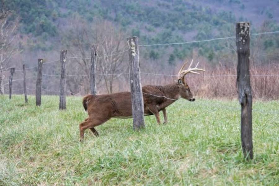
The best natural barriers for funneling deer are creeks and rivers, lakes and ponds, swamps and marshes, steep terrain, ravines and drainages, thick vegetation, and terrain transitions. These features funnel deer because they reduce the number of practical travel routes through an area and concentrate movement into narrower corridors.
A natural barrier does not need to stop a deer completely to create an effective funnel. Instead, it needs to make one route easier, safer, or more efficient than the surrounding options. A steep creek bank, for example, may direct deer toward a shallow crossing, while a swamp can concentrate movement onto a narrow strip of dry ground. When two barriers occur close together, the available travel space can become even narrower and form a pronounced pinch point.
For hunters, the value of a natural funnel depends on more than its appearance on a map. The barrier must influence actual deer movement, and that movement should be confirmed through concentrated trails, tracks, crossings, or other recurring deer sign. Understanding how different natural barriers shape these travel patterns makes it easier to identify promising funnels on topographic maps, aerial imagery, and during field scouting.
What Are the Best Natural Barriers for Funneling Deer?
The 7 best natural barriers for funneling deer are creeks and rivers, lakes and ponds, swamps and marshes, steep slopes and bluffs, ravines and drainages, thick vegetation, and restrictive terrain transitions. Each barrier changes how deer can move across the landscape, creating locations where several possible travel routes narrow into one or two practical paths.
Creeks and rivers create funnels when water depth, current, bank height, or surrounding terrain makes certain crossing points easier than others. Lakes and ponds work differently because deer generally have to travel around the body of water rather than directly through it. When the shoreline approaches another restrictive feature, such as a steep slope or dense cover, the remaining strip of usable ground forms a natural travel corridor.
Swamps and marshes funnel deer by separating easily traveled ground with wet, soft, or densely vegetated areas. A narrow strip of firm ground between two wet areas can therefore concentrate movement into a small space. Steep slopes and bluffs create a similar effect through elevation. Deer are physically capable of crossing difficult slopes, but easier routes such as benches, saddles, and gradual grades can provide more efficient paths through the terrain.
Ravines and drainages influence both lateral and lengthwise movement. Deer traveling across a deep drainage may concentrate around accessible banks or easier crossings, while deer moving through the same terrain may follow the drainage edge or another less restrictive route. Thick vegetation can also function as a barrier when briars, dense regeneration, or other heavy cover makes adjacent openings easier to travel.
Restrictive terrain transitions become particularly important when two features converge. A creek running close to a steep hillside, for example, leaves less usable ground between the water and slope. Likewise, two swampy areas separated by a narrow strip of dry ground can create a distinct pinch point. The strongest natural funnels are therefore determined by how much a barrier restricts usable travel space, not simply by the type of barrier present.
How Do Creeks and Rivers Create Deer Funnels?
Creeks and rivers create deer funnels by limiting convenient crossing locations and directing movement toward sections that are easier to approach, cross, and leave. Deer can cross water, so the water itself does not automatically create a funnel. The funnel develops when characteristics such as steep banks, water depth, surrounding vegetation, or adjacent terrain make a limited number of routes more practical than the alternatives.
A creek with consistently accessible banks may have little funneling effect because deer can cross along much of its length. The situation changes when most of the bank becomes steep or difficult to negotiate while one section remains relatively accessible. Deer movement can become concentrated around that section because it provides a lower-resistance route across the same barrier. Existing deer trails approaching the water from both sides provide stronger evidence that the crossing is repeatedly used rather than merely possible.
Bends and terrain intersections can strengthen this effect. For example, a creek positioned close to a steep slope can compress usable travel space between the two features. Deer traveling parallel to the creek are then presented with a narrower corridor, while deer crossing it may have fewer practical places to enter and exit the water. In this situation, the funnel is created by the relationship between the creek and surrounding terrain rather than by water alone.
Hunters should therefore evaluate the entire crossing structure instead of treating every creek as a deer funnel. Bank accessibility, adjacent cover, terrain restriction, trail concentration, and connections to the surrounding travel network determine whether a creek actually concentrates deer movement. A crossing with repeated tracks and established trails on both sides provides substantially more useful evidence than a convenient-looking crossing identified only from a map.
How Do Lakes and Ponds Funnel Deer Movement?
Lakes and ponds funnel deer movement by forcing land-based travel around their shorelines and narrowing the usable ground between water and surrounding terrain. Unlike a small creek that deer may cross at multiple locations, a larger body of water can create a longer obstruction. Deer traveling through the area are therefore more likely to follow routes around the water when doing so provides a more efficient path.
The strongest funnel develops where the space beside a lake or pond becomes restricted. A shoreline that approaches a steep hillside, swamp, bluff, or dense patch of vegetation can leave a narrow strip of easier terrain between two obstacles. Deer moving from one side of the area to the other have fewer practical routes, which can concentrate several travel paths through the remaining corridor. A 30-meter-wide strip of accessible ground between a pond and steep terrain, for example, represents a stronger physical constriction than several hundred meters of unrestricted shoreline.
The shape of the shoreline also affects where movement becomes concentrated. Points, narrow ends of ponds, coves, and locations where the shoreline approaches another terrain feature can reduce available travel space. However, the narrowest location is not automatically the most active deer funnel. Its value depends on whether it connects areas deer regularly travel between, such as bedding cover and feeding areas, and whether field evidence confirms repeated use.
Hunters can identify potential lake and pond funnels first through aerial imagery because the relationship between open water, vegetation, and surrounding land is usually visible from above. The next step is field verification. Concentrated trails, tracks, and repeated movement along the restricted shoreline provide stronger evidence that the terrain feature functions as an active funnel.
How Do Swamps and Marshes Create Natural Deer Funnels?
Swamps and marshes create natural deer funnels by reducing the amount of firm, easily traveled ground available to deer. Wet soil, standing water, dense vegetation, and irregular changes between wet and dry ground can make some routes less efficient than others. Deer movement can consequently become concentrated along dry edges, narrow strips of higher ground, and openings between wet areas.
A narrow dry corridor between two sections of wetland is one of the clearest examples. Deer moving across the broader landscape can use the firm strip instead of traveling through deeper water or difficult wetland vegetation. As the width of that dry ground decreases, movement has less room to disperse. The result is a natural pinch point where multiple travel routes may converge within a comparatively small area.
Swamp edges can also influence movement without creating an obvious narrow corridor. Deer may travel along the transition between wetland and upland cover because the edge provides a continuous route around more restrictive terrain. Corners and irregularities in the wetland can further compress these routes, particularly when another feature such as a ridge, creek, field edge, or dense cover limits movement from the opposite side.
The most useful swamp funnel is therefore not simply the wettest or narrowest location; it is a terrain restriction that connects an established deer travel network. A strip of dry ground that looks ideal on aerial imagery has limited value if deer have no reason to travel through it. Established trails entering and leaving the corridor, repeated tracks, and connections with nearby bedding or feeding areas provide stronger evidence that the swamp is actively funneling deer.
How Does Steep Terrain Funnel Deer?
Steep terrain funnels deer by making certain routes more difficult and concentrating travel along easier grades, benches, saddles, and gaps between restrictive slopes. Deer can move across steep ground, so a hillside does not become a funnel simply because it has a sharp grade. The funnel forms when the surrounding terrain makes one route more efficient than the available alternatives.
Steep slopes and bluffs create this effect by increasing the effort required to travel directly across an elevation change. A bench running across a steep hillside provides a comparatively level route, allowing deer to move along the slope without repeatedly climbing and descending. When the bench is narrow or connects two larger areas of usable terrain, it can function as a defined travel corridor. The funnel becomes stronger when another barrier, such as a creek or dense cover, restricts movement on the opposite side.
Saddles can produce a similar concentration of movement. A saddle is a lower area between two higher points along a ridge. Deer moving from one side of the ridge to the other may use the lower crossing rather than climbing over higher terrain. On a topographic map, this terrain relationship can help identify potential funnels before field scouting, but the terrain feature alone does not prove repeated deer use.
Bluffs and abrupt elevation changes can create more pronounced restrictions because they reduce the number of practical routes through an area. For example, a bluff running parallel to a creek can leave only a narrow band of accessible terrain between the two barriers. The combination of two restrictive features generally creates a clearer funnel than a broad steep slope with several alternative routes.
Field evidence should determine whether a terrain funnel is active. Established trails following a bench, tracks crossing a saddle, or several trails converging near the end of a bluff indicate that deer are responding to the terrain restriction. Without concentrated deer sign, steep terrain should be treated as a potential funnel rather than automatically classified as an active one.
How Do Ravines and Drainages Funnel Deer?
Ravines and drainages funnel deer by restricting movement across uneven ground and creating preferred routes either along or across the terrain feature. Their funneling effect depends on depth, bank steepness, width, surrounding cover, and the availability of easier crossings.
Deer moving across a deep ravine may encounter sections where the banks require a steep descent and climb. When a shallower section, gradual bank, or natural crossing interrupts that terrain, movement can become concentrated there. Several trails descending toward the same crossing and continuing on the opposite side provide a strong indication that the location is part of an established travel route.
Movement can also occur parallel to the drainage. The bottom, upper edge, or adjacent bench may provide a more efficient route than repeatedly crossing irregular terrain. This creates a different type of funnel: the drainage acts as a directional feature that guides movement rather than simply forcing deer toward one crossing. Hunters should therefore determine whether deer are traveling across the drainage or along it before interpreting the terrain.
The ends and intersections of ravines deserve particular attention because the restrictive terrain can weaken or converge there. A drainage terminating near another terrain feature may compress movement around its end, while two drainages approaching each other can leave a narrow section of usable ground between them. These locations become stronger candidates when they also connect larger areas of cover, bedding habitat, or feeding terrain.
Ravines and drainages are most valuable as funnels when their physical structure reduces several possible travel routes to a smaller number of practical ones. Topographic maps can reveal the terrain restriction, while field scouting confirms its actual use through trails, tracks, crossings, and other recurring deer sign.
How Does Thick Vegetation Create Deer Funnels?
Thick vegetation creates deer funnels by making some travel routes more difficult and directing deer toward openings, edges, narrow lanes, and other paths of lower resistance. Dense cover does not need to be completely impenetrable. It only needs to create enough difference in travel difficulty that deer consistently favor one route over the surrounding vegetation.
Briars, dense young forest growth, brush, and tightly packed understory can produce this effect. When a narrow opening passes through heavy vegetation, deer can use the opening while maintaining access to nearby cover. Repeated use can establish a defined trail, particularly when the opening connects two larger areas that deer regularly move between. The narrower the practical route becomes relative to the surrounding cover, the greater its potential to concentrate movement.
Edges between vegetation types can also guide deer. For example, the boundary between dense regeneration and mature timber creates a distinct terrain transition. Deer do not necessarily travel directly on the edge, but a consistent difference in vegetation density can influence where practical routes develop. An opening between two sections of thick cover can create an even stronger restriction because movement from several directions may converge before passing through the gap.
Vegetation funnels are less permanent than barriers created by major terrain features. Plant growth, forestry activity, storms, flooding, and other habitat changes can alter the amount of cover and open new travel routes. A funnel created by dense vegetation should therefore be evaluated according to its current condition rather than assuming that historical deer movement will remain unchanged.
An active vegetation funnel should show concentrated movement rather than merely an obvious opening in thick cover. Multiple trails merging into one path, repeated tracks, worn crossings, and a clear connection with the surrounding travel network provide stronger evidence that deer are actually using the opening.
Which Combinations of Natural Barriers Create the Strongest Deer Funnels?
The strongest natural deer funnels often occur where two or more barriers reduce the available travel space at the same location. These compound funnels can create a more defined pinch point because deer encounter restrictions from multiple directions rather than a single obstacle with several alternative routes.
A creek and steep slope are a common terrain combination. The creek restricts movement from one side while the slope increases travel difficulty from the other, leaving a narrower corridor between them. A similar pattern occurs where a bluff approaches a river or lake. As the distance between the two barriers decreases, deer traveling through the area have progressively less usable ground available.
Swamps can create strong compound funnels when combined with ridges, water, or additional wet areas. Two marshes separated by a strip of firm ground, for example, create a land bridge through otherwise restrictive terrain. A swamp approaching the base of a steep ridge can produce the same basic geometry: two barriers converge and leave a limited corridor between them.
Dense vegetation can strengthen an existing terrain funnel as well. A ravine may already reduce travel options, but thick cover near its easiest crossing can further restrict the number of approaches. Conversely, an opening through dense vegetation can become more important when a creek, wetland, or steep slope prevents deer from easily bypassing it.
Barrier combinations should be evaluated by the width and practicality of the remaining travel corridor rather than by the number of barriers alone. Two weak restrictions separated by a broad area may have little funneling effect, while a creek and bluff that converge closely can create a pronounced pinch point. The key mechanism is the progressive reduction of alternative travel routes.
The final test is repeated deer use. A visually impressive terrain constriction does not automatically function as a productive deer funnel. Concentrated trails, tracks, crossings, and connections to the broader movement network show whether deer actually respond to the combined barriers in the way the terrain suggests.
How Can You Find Natural Deer Funnels on a Topographic Map?
You can find potential natural deer funnels on a topographic map by identifying places where terrain features restrict several possible travel routes into a narrower corridor. The most useful features to examine are steep elevation changes, saddles, ravines, drainages, creek valleys, benches, and locations where two restrictive terrain features converge.
Contour lines provide the primary indication of terrain steepness. Closely spaced contour lines represent a rapid elevation change, while wider spacing indicates a gentler grade. When steep terrain dominates a hillside but a more gradual route interrupts it, that route can provide a lower-resistance path. Likewise, a bench visible as a flatter interruption across a steep slope can create a practical corridor along terrain that is otherwise more difficult to traverse.
Saddles are another recognizable feature. A saddle forms a lower point between two higher areas along a ridge, providing a potential route across the elevation feature. Ravines and drainages can be evaluated in the same way by looking for locations where steep contours become less restrictive or where the feature terminates. These changes can reveal possible crossings and routes around the end of restrictive terrain.
The strongest map-based candidates often appear where two barriers converge. A creek approaching a steep hillside, two drainages leaving a narrow ridge between them, or a bluff compressing usable ground beside water can create a visible pinch point. Instead of looking for isolated terrain features, hunters should examine how several features interact and determine how much usable travel space remains between them.
A topographic map identifies potential funnels rather than confirmed deer movement. It cannot establish whether deer regularly use a saddle, bench, drainage crossing, or narrow corridor. Map scouting should therefore narrow the search area, while trails, tracks, crossings, and other recurring deer sign provide field confirmation.
How Can You Find Deer Funnels on Aerial Imagery?
You can find deer funnels on aerial imagery by looking for narrow travel corridors created by water, wetlands, vegetation changes, openings, and other visible habitat boundaries. Aerial imagery complements a topographic map because it reveals surface features that contour lines alone may not show clearly.
Start by locating large barriers such as lakes, ponds, rivers, swamps, marshes, and extensive areas of dense cover. Then examine their edges for locations where the available land narrows. A strip of dry ground between two wetlands, a wooded corridor between open areas, or a narrow section between water and dense vegetation can indicate a potential funnel.
Vegetation transitions are particularly useful on aerial imagery. Boundaries between mature timber, younger growth, fields, wetlands, and other cover types can reveal likely travel corridors. A broad transition offers deer numerous route choices, while a narrow opening or corridor between restrictive cover types concentrates those choices into a smaller area.
The next step is to compare aerial imagery with topographic information whenever both are available. Aerial imagery shows what covers the ground, while a topographic map shows the shape of the ground. A narrow wooded strip may look promising from the air, for example, but elevation data may reveal an additional steep slope or drainage that further restricts movement. Conversely, the terrain may provide several alternative routes that make the apparent aerial funnel weaker than expected.
The final step is field verification. Identify the barrier, locate the narrowest practical route, determine what larger areas the corridor connects, and then inspect the location for recurring deer movement. This sequence prevents a visually attractive feature on aerial imagery from being mistaken for an active funnel without supporting deer sign.
What Signs Confirm That Deer Are Using a Natural Funnel?
Concentrated trails, repeated tracks, consistent crossings, droppings, rubs, and other recurring deer sign confirm that deer are using a potential natural funnel as part of their travel network. The strongest evidence is not a single sign but a pattern showing that deer repeatedly move through the restricted corridor.
Established trails provide the clearest starting point. A natural barrier becomes more significant when multiple trails converge as they approach a narrow crossing, strip of dry ground, saddle, opening in thick cover, or gap between two barriers. If those trails continue beyond the constriction, the pattern indicates that the location connects broader travel routes rather than ending at the barrier.
Tracks help determine whether those trails are currently being used. Repeated tracks entering and leaving the same restricted area provide stronger evidence than an old trail with little recent activity. Creek crossings, muddy swamp edges, soft drainage bottoms, and exposed soil can make track patterns particularly visible. Tracks on both sides of a barrier also help distinguish an actual crossing from a trail that merely follows the barrier.
Droppings and rubs add supporting context but should not independently define a funnel. A rub near a narrow corridor confirms deer presence but does not prove that movement is consistently concentrated there. Likewise, scattered droppings indicate deer activity without necessarily identifying the direction or frequency of travel. These signs become more useful when they occur alongside established trails and repeated tracks.
A confirmed deer funnel combines terrain restriction with concentrated evidence of repeated movement. The terrain explains why movement should narrow at that location, while deer sign demonstrates that animals actually use the route. This distinction prevents hunters from treating every narrow feature visible on a map as an active funnel.
How Do Bedding and Feeding Areas Affect a Deer Funnel?
Bedding and feeding areas affect a deer funnel by providing destinations that give deer a reason to travel through the restricted terrain. A natural barrier determines where movement can become concentrated, but the surrounding habitat helps determine whether deer regularly need to use that corridor.
A funnel positioned between bedding cover and a feeding area can connect two important parts of a deer’s movement pattern. For example, a narrow strip of usable terrain between a swamp and steep hillside becomes more relevant when it also connects secure cover with an established feeding destination. The physical constriction concentrates the route, while the destinations on either side create the movement that passes through it.
The same principle applies to funnels connecting multiple areas of cover. A saddle, creek crossing, or drainage gap may provide an efficient route between bedding areas or other frequently used habitat. In this case, the funnel should be evaluated as part of a larger network rather than as an isolated terrain feature. Hunters can trace established trails away from the pinch point to determine where those routes lead.
Distance and available alternatives also influence the strength of this relationship. A funnel may look restrictive but have limited importance when deer can reach the same destination through several nearby routes with similar travel costs. Conversely, a narrow corridor connecting two regularly used areas becomes more significant when surrounding barriers make alternative routes substantially less convenient.
The most relevant natural funnels combine three elements: a reason for deer to travel, terrain that restricts that movement, and field evidence showing repeated use. Bedding and feeding areas provide the movement context, natural barriers provide the physical restriction, and recurring deer sign confirms that the two are connected.
Read more: 7 Best Ways to Create Deer Bedding Cover
Do Deer Use the Same Natural Funnels Throughout the Year?
Deer can use the same natural funnels throughout the year, but the frequency and direction of movement through those funnels can change as seasonal conditions alter food, cover, and travel patterns. A creek, saddle, swamp edge, or narrow strip between barriers remains physically present, but its importance depends on whether current deer movement connects with that location.
Changes in food availability can shift the destinations deer travel toward. When a preferred feeding area changes, the travel routes connecting bedding cover with that food source can change as well. A funnel positioned on one of those routes may receive concentrated movement during one period and substantially less use after the primary destination shifts. The terrain still creates a potential funnel, but fewer deer may have a reason to pass through it.
Vegetation changes can also modify funnel strength. Dense foliage can make one corridor relatively restrictive during periods of active growth, while reduced vegetation can create additional travel options later. Wetlands and waterways can change as well when water levels alter which crossings and strips of firm ground are practical. A swamp funnel that concentrates movement under wetter conditions may become less restrictive when additional dry routes become available.
Seasonal changes should therefore be evaluated through current deer sign rather than assumptions based solely on previous observations. A heavily used trail from an earlier period confirms historical use, not necessarily current movement. Fresh tracks, recently used trails, and other recurring signs provide better evidence that the funnel remains active under present conditions.
A permanent terrain feature can create a long-term funnel, but its hunting relevance depends on when and why deer are using it. Hunters should treat the terrain as the structural component of the funnel and current movement evidence as the temporal component.
What Makes a Natural Deer Funnel Better Than the Surrounding Terrain?
A strong natural deer funnel has 6 defining characteristics: restricted travel space, limited alternative routes, an efficient path through the barrier, useful surrounding cover, connections to deer destinations, and repeated evidence of deer movement. The quality of a funnel depends on these characteristics working together rather than on the presence of a particular creek, swamp, ridge, or other terrain feature.
Restricted travel space determines how tightly movement can be concentrated. A broad creek bottom with accessible crossings along its entire length provides numerous choices and therefore creates little physical concentration. A creek with steep banks and one accessible crossing produces a much narrower set of options. The same principle applies to swamps, steep slopes, ravines, and dense vegetation.
Limited alternatives strengthen the restriction. A narrow corridor becomes less significant when deer can easily bypass it nearby. Compound barriers can reduce these alternatives more effectively. A strip of usable terrain between a creek and bluff, for example, restricts movement from two sides and can create a more defined corridor than either feature would produce independently.
An efficient route through the restriction also matters. Saddles provide lower crossings through ridges, benches provide easier travel across steep slopes, and firm ground provides practical passage through wetlands. These features create funnels because they offer comparatively efficient routes through or around more difficult terrain.
Surrounding cover and deer destinations determine whether the terrain restriction fits into a broader movement pattern. A pinch point connecting bedding cover with feeding terrain has a clear reason for repeated travel. A similar-looking pinch point disconnected from regularly used habitat may receive substantially less movement.
Repeated deer sign provides the final confirmation. Trails converging into the corridor, fresh tracks passing through it, consistent crossings, and supporting sign demonstrate actual use. The best natural barrier for funneling deer is therefore the one that removes alternative routes while leaving an efficient corridor deer repeatedly use to reach relevant destinations. Barrier type matters, but terrain geometry, surrounding habitat, and confirmed movement determine the actual strength of the funnel.