
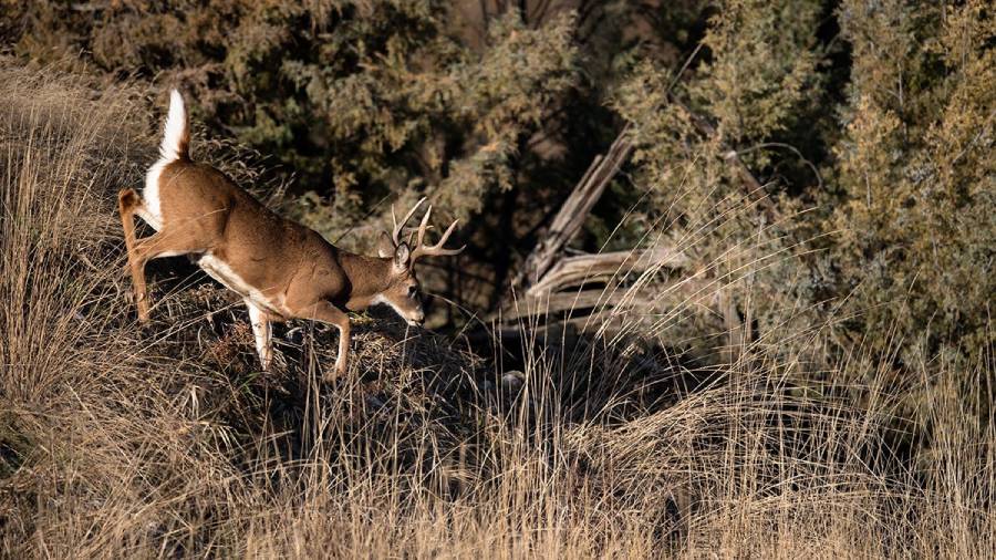
Yes, deer use ravines as travel routes when these terrain features provide cover, connect important destinations, or create an efficient path through steep ground. Whitetail deer may travel along a ravine bottom, follow its side slopes, cross at a shallow point, or move around its head rather than using one fixed route. The exact path depends on the shape of the terrain and where the deer are trying to go.
Ravines become particularly relevant to hunters when they connect bedding areas, feeding areas, water sources, or other frequently used locations. Steep banks and changes in elevation can also concentrate movement into specific crossings and terrain funnels. However, the presence of a ravine alone does not mean deer consistently travel through it. Active trails, tracks, rubs, scrapes, bedding cover, wind conditions, seasonal behavior, and hunting pressure provide stronger evidence of how deer actually use the terrain.
Understanding these movement patterns helps hunters distinguish a productive travel corridor from an unused drainage. This guide explains why deer use ravines, which parts they are likely to travel through, how to identify active routes, when ravine movement changes, and where these terrain features can create useful hunting setups.
Do Deer Use Ravines as Travel Routes?
Yes, deer use ravines as travel routes when the terrain helps them move between bedding areas, feeding areas, water sources, and other frequently used locations. A ravine can function as a travel corridor because its shape influences where deer can move efficiently and where they remain concealed. However, deer do not automatically follow every ravine from one end to the other. They select routes according to the surrounding terrain, cover, destination, and perceived risk.
The route can occur in several parts of the ravine. Deer may follow the bottom when it provides relatively easy footing and sufficient cover, travel along a side slope when the bottom is difficult to navigate, or cross where the banks become less steep. They may also move around the head of a ravine because doing so requires less elevation change than descending and climbing the drainage. For hunters, this means the ravine itself is less important than the specific terrain features that concentrate movement within or around it.
A ravine becomes more valuable as a travel corridor when it connects locations deer already need to visit. For example, a wooded ravine extending from thick bedding cover toward an agricultural feeding area creates a logical connection between two important destinations. A ravine that does not connect bedding, food, water, security cover, or another useful terrain feature has less reason to receive consistent deer traffic.
Hunters should therefore treat ravines as parts of a larger deer movement system rather than isolated hunting spots. Established trails entering or leaving a ravine, repeated crossings, tracks, rubs, scrapes, and other fresh deer sign provide stronger evidence of a travel route than the presence of the ravine alone.
Why Do Deer Use Ravines for Travel?
Deer use ravines for travel primarily because ravines can provide security cover, reduce the effort required to cross difficult terrain, connect important destinations, and concentrate movement into predictable routes. The importance of each factor changes with the shape and vegetation of the ravine, so two nearby ravines can receive very different levels of deer traffic.
Security cover is one important reason. A wooded or brush-filled ravine can conceal a deer more effectively than an exposed field, open hillside, or sparsely covered ridge. Terrain itself can also block lines of sight. This makes a covered ravine useful when deer need to travel between secure bedding cover and another destination without spending the entire route in exposed terrain. The value increases when hunting pressure makes open travel routes less attractive during daylight.
Terrain efficiency also affects the route deer choose. Deer are capable of moving through steep country, but they do not need to take the steepest possible line when an easier route reaches the same destination. Gradual side slopes, benches, shallow crossings, ravine heads, and relatively open bottoms can provide lower-resistance paths around abrupt elevation changes. As a result, a hunter may find a heavily used trail partway up a ravine rather than directly in its bottom.
Ravines can also connect bedding and feeding areas. Consider a deer bedding on elevated, thickly covered ground and feeding in a field below. A ravine running between those locations may provide part of the travel route, particularly when vegetation along the drainage offers continuous cover. The same principle applies when a ravine connects bedding cover with a creek bottom, oak flat, agricultural field, or another destination deer regularly use.
Finally, ravines can create funnels. Steep banks, abrupt cuts, narrow crossings, and changes in slope can restrict the number of practical routes through an area. Several broader deer trails may therefore converge near one easier crossing or around the head of the ravine. These terrain-induced convergence points are more significant to hunters than simply finding a ravine because they identify locations where deer movement becomes more concentrated and predictable.
Where Do Deer Travel in a Ravine?
Deer travel through five main parts of a ravine: the bottom, side slopes, upper edges, head, and crossing points. The most heavily used position depends on slope steepness, vegetation, obstacles, nearby bedding and feeding areas, and the direction deer need to travel. Hunters should therefore identify the easiest and most secure route through the terrain rather than assuming deer always walk along the lowest point.
Ravine bottoms can become natural travel lanes when they are relatively dry, open enough for efficient movement, and covered by vegetation. A bottom that runs toward a feeding area or connects two blocks of security cover has an additional reason to receive regular traffic. In contrast, standing water, dense obstacles, erosion, exposed ground, or abrupt drops can make the bottom less practical. Under those conditions, deer may shift onto a side slope or leave the ravine entirely.
Side slopes can support parallel travel routes that follow the general direction of a ravine without placing deer at its lowest point. Gradual slopes and benches are particularly important because they provide flatter sections within otherwise steep terrain. A trail that maintains a similar elevation along the side of a ravine can allow deer to travel across the terrain without repeatedly descending and climbing.
Upper edges also deserve attention. Deer moving between elevated bedding cover and lower destinations may travel near the edge before entering the ravine at a favorable location. The result can be a trail that appears to follow the ravine from above rather than through its bottom. Hunters scouting only the drainage floor can miss these higher routes.
Do Deer Travel Along the Bottom or Sides of Ravines?
Deer can travel along both the bottom and sides of ravines, but they favor the route that provides the best combination of efficient movement, security, and access to their destination. A gradual, covered bottom may become the primary corridor, while a steep, wet, obstructed, or exposed bottom can shift movement toward the sides.
The surrounding terrain provides the context needed to interpret these trails. For example, a side trail that connects directly with a bedding area can carry more meaningful traffic than an obvious trail running down the bottom. Conversely, a narrow ravine with steep walls may leave the bottom as the easiest continuous path. Hunters should follow trails far enough in both directions to determine what they connect instead of judging their importance solely by trail width.
Multiple routes can also exist within the same ravine. Does, bucks, and individual deer do not have to use an identical line, and movement can shift as food availability, cover, hunting pressure, or seasonal behavior changes. A secondary side trail may therefore become more important at a different point in the season.
Do Deer Cross Ravines or Travel Around the Head?
Deer cross ravines when a practical crossing provides an efficient route to their destination, while the head of a ravine can concentrate movement when crossing the deeper section requires more effort. This means the same ravine can function as both a travel corridor and a terrain barrier depending on where a deer encounters it.
Crossings become important where the banks flatten, the ravine narrows, or another terrain feature creates a practical route from one side to the other. A deer trail approaching the ravine from both directions and continuing beyond it provides stronger evidence of a consistent crossing than tracks found only in the bottom. Several trails converging on one crossing indicate that terrain is concentrating movement.
The head of a ravine can produce a different type of funnel. Deer traveling across a hillside may move around the upper end instead of descending into a deep cut and climbing the opposite side. When several possible approaches are compressed around that point, the head can become a predictable travel location.
However, hunters should not assume every ravine head or shallow crossing is productive. Its hunting value depends on what lies beyond it. A crossing that connects bedding cover with a feeding destination has a clear movement function, while an equally easy crossing that leads nowhere deer regularly need to travel may receive substantially less use.
What Makes a Ravine a Good Deer Travel Corridor?
A good deer travel corridor in a ravine combines a useful destination, security cover, efficient terrain, established trails, and movement-concentrating features. The strongest ravines are integrated into a larger route between locations deer regularly use rather than existing as isolated terrain depressions.
Connections are the first factor to examine. Deer have a reason to travel when moving between bedding areas, feeding areas, water sources, breeding activity, and seasonal resources. A ravine positioned between these locations can provide part of that route. Hunters can examine aerial imagery and topographic maps to identify potential connections, then use ground scouting to determine whether deer actually follow them.
Security cover strengthens a route because vegetation and terrain can reduce exposure. Thick brush, timber, young growth, and steep terrain can conceal movement, especially compared with adjacent open ground. The relationship between cover and destination matters more than cover alone. A densely vegetated ravine that connects two frequently used areas has greater travel-route potential than thick cover with no clear movement function.
Terrain resistance determines where movement becomes concentrated within that corridor. Deer can encounter steep banks, erosion cuts, water, fallen trees, rock, and abrupt elevation changes inside a ravine. Easier alternatives such as shallow crossings, gradual slopes, benches, and ravine heads can consequently collect trails from a wider area. These locations function as terrain funnels because several potential routes narrow into fewer practical routes.
Established deer sign provides the final confirmation. A well-defined trail is useful evidence, but its context determines its value. Repeated tracks, multiple connecting trails, rubs, scrapes, droppings, and other fresh sign can strengthen the case that deer consistently use the location. Hunters should also determine where the trail originates and where it leads. The best evidence of a productive ravine travel corridor is not simply a visible trail; it is a repeatedly used trail that connects terrain and destinations important to deer.
How Can You Tell If Deer Are Using a Ravine as a Travel Route?
You can tell deer are using a ravine as a travel route by finding repeated deer sign that forms a consistent path through, along, or across the terrain. The strongest evidence comes from established trails supported by fresh tracks, repeated crossings, rubs, scrapes, droppings, or other sign. One isolated track or rub confirms that a deer visited the location, but it does not prove the ravine functions as a regular travel corridor.
Start with established trails because they show repeated movement over the same ground. Look for trails entering the ravine, following its bottom or sides, crossing at shallow points, or wrapping around its head. A trail becomes more meaningful when it continues beyond the ravine toward bedding cover, feeding areas, water, or another destination. Multiple trails converging at one location can also reveal a terrain funnel where the ravine restricts several movement options into a smaller travel zone.
Tracks help determine whether those trails are currently active. Mud, exposed soil, creek edges, sandy ground, and other soft surfaces can preserve hoofprints more clearly than leaf litter or hard ground. Fresh tracks on an established trail provide stronger evidence than an old trail with no recent activity. The direction of several tracks can also help hunters understand whether deer are moving through the ravine, crossing it, or simply entering a small portion of it.
Rubs and scrapes provide additional information, particularly when evaluating buck movement. A sequence of rubs associated with the same trail is more useful for identifying a travel pattern than a single rub standing away from an established route. Scrapes positioned near trail intersections or terrain funnels can also add context. These signs should be evaluated together with terrain and trail direction rather than treated as independent proof that a location is consistently productive.
Hunters should also examine how several types of sign relate spatially. For example, a defined side-hill trail with fresh tracks that leaves thick bedding cover, passes a series of rubs, crosses the head of a ravine, and continues toward a feeding area provides a coherent movement pattern. The same collection of signs is more informative than any individual track, rub, or trail because each piece supports the same travel route.
Trail cameras can provide another layer of confirmation where their use is legal. Camera observations can show whether deer use the route repeatedly, which direction they travel, what time movement occurs, and whether bucks and does use the same section differently. Cameras are most useful after terrain and physical sign have identified a likely route rather than as a substitute for understanding why deer are moving through the location.
The key distinction is repeated movement versus isolated presence. Finding deer sign inside a ravine proves deer have been there. Finding fresh sign distributed along a logical route that connects important destinations provides much stronger evidence that deer are using the ravine as a travel corridor.
When Do Deer Use Ravines Most Often?
Deer use ravines when the terrain supports their current movement needs, so ravine activity changes with daily bedding-to-feeding movement, seasonal food sources, breeding behavior, cover, and hunting pressure. A ravine that receives regular traffic during one part of the season can become less important after food sources, bedding patterns, or deer behavior changes.
During routine movement, ravines are most relevant when they lie between bedding and feeding areas. Deer leaving secure bedding cover may use a covered drainage, side slope, or ravine edge for part of the route toward food. Movement can reverse when deer return toward bedding areas. This relationship means hunters should identify both ends of a ravine trail rather than evaluating it without knowing the destinations it connects.
Seasonal changes can alter these connections. A route leading toward a currently attractive food source can receive substantial use and then decline when that food becomes unavailable or deer switch to another resource. Changes in vegetation can also alter security cover. A travel route that is concealed by dense foliage early in the season may become more exposed after leaf drop, potentially affecting when and how deer use it.
Hunting pressure can change ravine movement as well. Human entry, repeated stand access, scent, and encounters with hunters can cause deer to alter established patterns. Covered ravines and less exposed side routes may become important when they allow movement away from frequently disturbed locations. However, pressure can also reduce activity in a ravine when hunters repeatedly enter or cross the same corridor. A productive terrain feature can lose value when access continually disturbs the deer using it.
Time of day also matters because the same route does not necessarily receive equal use throughout a 24-hour period. A trail can carry substantial nighttime movement while producing little daylight activity. For hunting purposes, the critical question is therefore not simply whether deer use the ravine, but whether they use the specific section during legal hunting hours. Bedding proximity, security cover, disturbance, and the location of the destination all influence that timing.
Do Bucks Use Ravines as Travel Routes During the Rut?
Yes, bucks can use ravines as travel routes during the rut, particularly when the terrain connects doe-use areas or creates efficient routes between locations where bucks search for receptive does. Rut behavior can expand buck movement beyond the more predictable bedding-to-feeding patterns seen during other periods.
Terrain funnels become especially relevant when bucks are covering ground. A ravine head, shallow crossing, bench, or narrow strip of usable terrain can concentrate movement when it lies between areas regularly occupied by does. Bucks do not need to follow a ravine for its entire length for the terrain to matter. They may use only one crossing or travel around one head because that location provides the most efficient connection between two larger movement areas.
Rut sign can help hunters evaluate these routes. Rubs and scrapes associated with established trails can indicate buck activity, but their position within the larger terrain pattern is more important than the presence of an isolated sign. A rub line following a side trail toward a crossing, for example, provides more information about movement than a single large rub with no identifiable route around it.
Hunters should avoid assuming that every ravine automatically becomes a rut funnel. The ravine still needs to connect places bucks have a reason to visit. A terrain pinch between doe bedding areas, for example, has a clearer function than an isolated ravine surrounded by habitat offering little food, bedding cover, or doe activity. During the rut, the strongest ravine routes combine favorable terrain with the locations and movement patterns of deer already using the surrounding habitat.
How Do Wind and Thermals Affect Deer Travel in Ravines?
Wind and thermals affect how deer travel through ravines because changes in elevation and terrain shape influence scent movement. A ravine can channel air along its length, pull air toward lower elevations, or create inconsistent currents where the main wind interacts with slopes and vegetation. For hunters, this means a productive deer trail can still be difficult to hunt when air movement carries human scent toward approaching deer.
Thermals are especially relevant in terrain with noticeable elevation changes. As the ground warms, rising air can move scent uphill. As the terrain cools, descending air can carry scent toward lower ground. A hunter positioned above or below a ravine travel route can therefore experience different scent movement as temperatures change. The effect is important around morning and evening transition periods because the direction of thermal movement can change while deer are traveling between bedding and feeding areas.
Ravine shape can make this process less predictable. A narrow drainage surrounded by steep slopes does not always receive the same airflow as exposed terrain above it. The prevailing wind may pass across the top while air inside the ravine follows terrain contours or changes direction around bends, side drainages, vegetation, and elevation differences. These interactions can produce shifting or swirling currents that make a seemingly favorable wind unreliable at the exact hunting location.
Hunters should evaluate wind at the specific stand location rather than relying only on a general forecast. Checking air movement at different elevations around the ravine can reveal whether scent stays away from the expected deer route. The same setup should also account for the hunter’s entry and exit because walking through the ravine or crossing the primary trail can introduce scent before the hunt begins.
Wind also affects how useful a particular ravine route is on a given hunt. A crossing may contain excellent deer sign but place approaching deer directly downwind of the stand under a common wind direction. Another trail farther along the ravine may provide a cleaner relationship between deer movement and hunter scent. The best ravine setup combines an active travel route with wind and thermal conditions that keep the hunter’s scent away from both the trail and the area from which deer are expected to approach.
Where Should You Hunt Deer Around a Ravine Travel Route?
The best places to hunt around a ravine travel route are terrain features that concentrate deer movement while allowing the hunter to approach, hunt, and leave without contaminating the primary route. Ravine heads, established crossings, side-hill trails, terrain pinches, and connections near bedding or feeding areas can meet these conditions. The best location depends on how deer use the entire ravine rather than which terrain feature looks most distinctive on a map.
Ravine heads deserve attention when deer traveling across a slope avoid descending into a deeper section. Several trails can converge around the upper end where crossing requires less elevation change. This concentration creates a potential funnel. Ground scouting should confirm the pattern because a ravine head with no connecting trails or useful destinations has little hunting value regardless of how promising it appears on a topographic map.
Established crossings provide another potential setup. A shallow bank, narrow cut, gradual slope, or other low-resistance section can concentrate deer moving perpendicular to the ravine. The strongest crossings have trails that clearly continue on both sides and connect meaningful habitat. Fresh tracks and repeated use increase confidence that the crossing is active rather than an occasional route.
Side-hill trails can be productive when deer travel parallel to a ravine. These routes may occur on benches or gradual slopes that allow deer to maintain elevation while moving between destinations. Because a hunter looking only at the bottom can overlook them, scouting both sides of the drainage is necessary. Following the trail far enough to identify its relationship with bedding, feeding, or another terrain feature helps determine whether it carries destination-based movement.
Connections near bedding areas require greater caution. A route close to bedding cover can provide opportunities to encounter deer before they complete a longer movement toward food, but aggressive access can also disturb the area. The hunter must consider where deer are likely to bed, where they enter the route, and whether the stand can be reached without crossing the trail or allowing scent to enter the bedding cover.
Feeding-side connections offer a different setup. A ravine that empties near an agricultural field, oak flat, or another feeding area may contain trails approaching that destination. Hunting farther back along the route can provide a chance to encounter deer before they reach the food source, while hunting too close to an exposed destination may result in more movement after legal shooting light. The appropriate position depends on cover, timing, access, and wind.
Terrain pinches are valuable because they reduce the number of practical paths available. For example, a steep ravine on one side and another obstacle on the opposite side can leave a narrower strip of comfortable terrain between them. If deer trails converge through that strip, the terrain has transformed broad movement into a more predictable corridor. The convergence of active trails is the important evidence; the pinch itself does not guarantee deer use.
Should You Hunt the Bottom or Top of a Ravine?
You should hunt the part of a ravine that intersects the active deer route and provides a favorable wind, rather than automatically choosing the bottom or top. The bottom is preferable when established trails follow the drainage and the hunter can access the location without sending scent through the corridor. The upper portion is preferable when deer side-hill, travel along the edge, cross near the head, or when hunting above the ravine provides better scent control.
Bottom setups can offer close access to trails concentrated by steep terrain, but they can also create scent problems. Descending thermals may carry human scent into the drainage, while irregular terrain can produce changing air currents. Walking up the ravine bottom can also contaminate the same corridor deer are expected to use. A visually obvious bottom trail is therefore not automatically the best place for a stand.
Higher setups can provide access to side trails, benches, crossings, and ravine heads while keeping the hunter away from the drainage floor. However, elevation alone does not make a location superior. A stand above the ravine has limited value when the primary deer trail stays below it or the wind carries scent directly toward bedding cover.
The decision should follow a consistent sequence: identify the active travel route, determine where it connects important destinations, evaluate wind and thermal behavior, and then choose a position that can be entered and exited with minimal disturbance. This approach treats stand placement as the final step of terrain analysis rather than selecting a location simply because it is at the top or bottom of a ravine.
Read more: Why Are Bucks Not Making Rubs? 7 Possible Reasons
What Mistakes Do Hunters Make When Hunting Ravines?
The 6 main mistakes hunters make when hunting ravines are assuming every ravine is a deer corridor, hunting a trail without identifying its destination, ignoring wind and thermals, using poor access routes, relying on old deer sign, and overlooking alternative trails. These mistakes usually occur when a hunter focuses on the appearance of the terrain feature instead of determining how deer actually move through it.
The first mistake is assuming the presence of a ravine automatically creates a productive travel route. A ravine influences movement, but deer still need a reason to use it. A drainage connecting bedding cover with a feeding area has a clear function within the local movement system. Another ravine with difficult terrain, limited cover, and no connection to an important destination may receive little consistent traffic. Fresh sign should confirm the terrain hypothesis before a hunter commits to the location.
The second mistake is hunting an obvious trail without determining where it goes. A heavily worn trail through the bottom or along a side slope shows repeated animal movement, but its hunting value depends on its function. Hunters should trace the route far enough to determine whether it connects bedding cover, feeding areas, crossings, or other deer-use locations. Understanding both ends of the trail also helps predict the direction and timing of movement.
Ignoring wind and thermals is the third mistake. Ravines contain elevation changes that can influence air movement, and the wind experienced on exposed high ground may differ from air movement inside the drainage. A stand positioned directly beside an active trail can fail when descending thermals or swirling currents repeatedly carry human scent into the corridor. Wind should therefore be evaluated at the actual hunting elevation and under conditions similar to those expected during the hunt.
Poor access creates a fourth problem. The most direct route to a stand is not necessarily the least disruptive route. Walking through the ravine bottom, crossing an established trail, or approaching through bedding cover can leave scent and alert deer before the hunt begins. Effective access should avoid the primary travel corridor and reduce the chance of encountering deer while entering or leaving.
The fifth mistake is relying on old sign. Old rubs, faded tracks, abandoned scrapes, and well-worn trails can reveal historical use without proving current activity. Deer movement changes as food sources, vegetation, hunting pressure, and seasonal behavior change. Fresh tracks, recently worked scrapes, current trail-camera observations where legal, and repeated new sign provide stronger evidence that a route remains active.
The sixth mistake is focusing on one obvious trail while overlooking alternatives. A ravine may contain routes along the bottom, both side slopes, upper edges, crossings, and its head. Deer can also shift between these routes as conditions change. Scouting the surrounding terrain helps reveal whether the obvious trail is the primary corridor or only one component of a larger movement system.
Avoiding these mistakes requires hunters to evaluate three elements together: terrain, current deer sign, and the destinations connected by the route. A ravine becomes useful for hunting when all three indicate predictable deer movement and the location can be hunted without excessive disturbance.
Are Ravines Better Deer Travel Routes Than Ridges or Creek Bottoms?
Ravines are not inherently better deer travel routes than ridges or creek bottoms because each terrain feature influences deer movement differently. The most productive feature is the one that connects locations deer currently use while providing suitable terrain, cover, and security. In hilly country, a single deer travel route can incorporate all three features rather than remaining exclusively in a ravine, on a ridge, or beside a creek.
Ravines are especially useful where their shape concentrates movement. Steep sides can restrict crossing opportunities, while shallow crossings, side slopes, and ravine heads provide easier alternatives. These differences can produce funnels that make deer movement more predictable. Ravines can also provide concealed connections between higher and lower terrain when vegetation and topography reduce exposure.
Ridges influence movement through elevation and connectivity. Deer may follow ridge systems, travel along their sides, use saddles between high points, or leave a ridge where another terrain feature provides access to bedding or feeding habitat. A ridge can therefore form one section of a longer route before deer descend through a ravine or move toward a creek bottom.
Creek bottoms provide another type of low-terrain corridor. Their usefulness depends on surrounding cover, bank structure, crossings, water conditions, and the destinations they connect. A creek can guide movement along its length, while steep banks or deep water can concentrate crossings at specific locations. Where a creek runs through a ravine, the combined terrain features may create an even more defined movement pattern.
The relationship among these terrain features matters more than ranking them individually. For example, a buck could leave a bedding area near a ridge, follow a side-hill trail, move around the head of a ravine, cross through a saddle, and eventually descend toward a creek bottom. Each terrain feature performs a different function within the same route.
Hunters should therefore ask where the terrain directs deer next rather than whether one feature is universally superior. Topographic and aerial maps can identify potential ridges, drainages, saddles, crossings, and habitat transitions, while ground scouting confirms which connections contain current deer activity. The strongest hunting locations are often where multiple terrain influences intersect and compress movement into fewer practical routes.
For ravines specifically, the key principle remains consistent: a ravine is most valuable when it forms a functional connection within the larger deer movement system. Terrain alone identifies possibilities. Fresh deer sign, route direction, destination, wind, and access determine whether that possibility becomes a practical hunting location.