
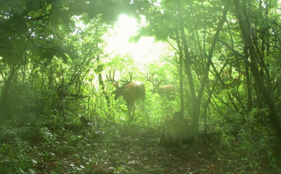
A deer travel corridor can be identified by looking for repeated deer sign along terrain that connects bedding areas, feeding areas, water sources, and other frequently used locations. The strongest deer travel corridors show multiple signs of consistent movement, such as worn trails, fresh tracks, rubs, scrapes, terrain funnels, crossings, and converging trails. A single track or faint trail shows that a deer passed through an area, but it does not prove that deer regularly use the same route.
Hunters can identify reliable corridors by combining physical sign with the way the surrounding terrain influences deer movement. Saddles, creek crossings, pinch points, cover transitions, and narrow strips of vegetation can concentrate deer onto predictable routes. The location of nearby bedding and feeding areas provides additional context because deer often use corridors to move between these destination areas.
The final step is confirming that the corridor is active. Fresh sign establishes recent use, while repeated trail-camera observations can reveal how frequently deer pass through, which direction they travel, and when movement occurs. Using these layers of evidence prevents hunters from treating every visible deer trail as an equally valuable travel corridor. The 7 signs below provide a practical framework for identifying the routes that show the strongest evidence of repeated deer movement.
What Are the 7 Signs of a Deer Travel Corridor?
There are 7 primary signs of a deer travel corridor: well-used trails, repeated tracks, rubs and scrapes, terrain funnels, creek or fence crossings, routes connecting bedding and feeding areas, and multiple trails converging in one location. The strongest corridor contains several of these signs along the same route. Each additional form of evidence increases confidence that deer repeatedly travel through the area rather than simply passing through once.
1. Well-used deer trails are the most visible sign of repeated movement
An established trail can have compressed vegetation, exposed soil, disturbed leaves, or a defined path through thick cover. Trail continuity matters as much as trail visibility. Follow the route far enough to determine whether it continues toward bedding cover, feeding areas, a crossing, or another location deer have a reason to visit. A short trail that disappears after several yards provides less evidence than a continuous route connecting two important areas.
Trail width alone does not determine the value of a corridor. Several deer can create an obvious trail, while mature bucks may use less conspicuous routes along the edge of heavier deer traffic. Look at the trail as one component of a larger movement system rather than assuming the widest trail automatically represents the best hunting location.
2. Repeated deer tracks show that deer have physically used the route
Multiple hoofprints following the same line provide stronger evidence than one isolated track. Tracks can also help determine the size of deer using the area, their direction of travel, and whether movement occurred recently when ground conditions allow tracks to be aged with reasonable confidence.
Track concentration becomes especially useful at locations where deer movement is naturally compressed. Muddy creek banks, field entrances, fence crossings, narrow openings, and soft ground can preserve tracks more clearly than dry forest floors. Finding repeated tracks at several points along the same trail strengthens the case that the route functions as a corridor.
3. Rubs and scrapes provide additional evidence of buck movement
Rubs occur where bucks work their antlers and forehead against trees, while scrapes are ground-level communication sites associated with deer behavior. A single rub or scrape confirms activity at a location, but a sequence of sign positioned along an established trail provides more useful information about repeated movement.
The spatial relationship between sign matters. For example, several rubs extending along a trail between secure cover and a terrain funnel provide more context than one isolated rub beside an otherwise inactive trail. Hunters should therefore use rubs and scrapes as supporting evidence rather than treating either sign as proof of a travel corridor by itself.
4. Funnels and pinch points reveal locations where terrain or cover concentrates deer movement
A funnel reduces the number of practical routes available to a deer, increasing the likelihood that multiple animals will pass through a relatively narrow area. Examples include narrow strips of cover between open areas, gaps between obstacles, saddles, strips of timber connecting larger blocks of cover, and constricted routes around steep terrain.
A terrain funnel becomes a stronger corridor candidate when physical sign confirms the predicted movement. An appealing pinch point on a map only shows where deer could travel. Worn trails, repeated tracks, crossings, rubs, or trail-camera observations show whether deer actually use it.
5. Creek and fence crossings identify specific points where deer repeatedly cross an obstacle
Deer often develop recognizable crossing locations where creek banks are manageable or fences provide an easier passage. Because these features concentrate movement into small areas, tracks and trails can be easier to identify there than across unrestricted terrain.
Check both sides of a suspected crossing. An established trail entering the obstacle and continuing beyond it provides stronger evidence than tracks ending at one side. Multiple fresh tracks using the same crossing further indicate that the location belongs to a larger travel route rather than representing a single crossing event.
6. Routes connecting bedding and feeding areas have a clear movement purpose
Deer do not travel through the landscape randomly. Bedding cover, food, water, security cover, and seasonal resources create destinations, while travel corridors connect those destinations. A trail positioned between known bedding cover and a reliable food source therefore has greater contextual value than an identical trail with no obvious destination relationship.
Hunters can use this relationship in reverse when scouting. Identify likely bedding and feeding areas first, examine the terrain between them, and then search for physical sign along the most practical routes. This approach combines deer sign with landscape context instead of relying entirely on whatever trail is easiest to see.
7. Multiple deer trails converging in one location can reveal a concentrated travel corridor
Deer approaching from separate bedding pockets, feeding areas, or pieces of cover may use different secondary trails before those trails merge at a funnel, crossing, or other constrained location. The convergence creates a smaller area through which a larger share of movement can pass.
Not every trail intersection is equally valuable. Confirm that the converging trails contain current sign and determine where they lead. A junction containing fresh tracks on several connected trails and positioned between known destination areas provides stronger evidence than a complicated network of old trails with little recent activity.
The 7 signs work best as a combined identification system. Terrain predicts where a corridor should occur, trails establish a physical route, tracks and deer sign demonstrate use, and destination areas explain why deer are traveling through it. When several of these signals overlap in the same location, a hunter has substantially stronger evidence of a deer travel corridor than any single sign can provide.
How Can You Tell Whether a Deer Travel Corridor Is Active?
An active deer travel corridor contains fresh, repeated signs of deer movement along the same route. The most useful evidence includes fresh tracks, recently disturbed leaves or soil, fresh droppings, active rubs or scrapes, and repeated trail-camera observations. An established trail without recent sign proves that deer have used the route in the past, but it does not confirm that they are using it during the current hunting period.
Start by evaluating the freshness and distribution of physical sign. Fresh tracks in soft soil or mud provide stronger evidence when several prints continue in the same direction rather than appearing at a single point. Recently disturbed leaves, compressed vegetation, or exposed soil can provide additional evidence of regular traffic. Fresh droppings along or near the route add another layer of confirmation. During periods of buck activity, recently worked rubs and active scrapes can indicate that bucks are using the surrounding travel system.
The location of fresh sign is also important. Several types of recent sign spread along the same trail provide stronger evidence than a large amount of sign concentrated in one isolated spot. For example, fresh tracks at a creek crossing, additional tracks farther along the trail, and a recently used scrape near a trail intersection form a connected pattern. That pattern shows movement through the landscape rather than activity at only one location.
Hunters should also compare multiple possible routes. A visually obvious trail with little fresh evidence may receive less current use than a narrower trail containing repeated fresh tracks. This distinction matters because old trails can remain visible long after deer movement patterns change. Food availability, security cover, seasonal behavior, and hunting pressure can shift deer away from routes that were active earlier.
How Can a Trail Camera Confirm an Active Deer Corridor?
A trail camera confirms an active deer corridor by recording repeated deer movement through the same location over time. Camera observations add information that tracks and trails cannot reliably provide on their own, including movement frequency, time of passage, travel direction, and the individual deer using the route.
Place the camera where the corridor naturally concentrates movement rather than where deer can pass through a wide area on numerous routes. Trail intersections, funnels, pinch points, creek crossings, fence crossings, and narrow sections of cover provide useful monitoring locations because passing deer are more likely to enter the camera’s detection area. Positioning the camera to observe a section of the trail can also make travel direction easier to determine.
A single photograph confirms that one deer used the route at one moment. Repeated observations are the stronger indicator of an active travel corridor. For example, several deer moving through the same pinch point on different days establish a more consistent movement pattern than one buck appearing once during the scouting period. Repeated images of the same deer can also reveal whether a specific animal includes the corridor in its regular movement pattern.
Camera timestamps add another layer of hunting context. They show whether most movement occurs during daylight, near dawn or dusk, or after dark. Two corridors can therefore contain similar physical sign while having different hunting value. One may consistently produce deer movement during legal hunting hours, while another receives most of its traffic at night.
The most reliable assessment combines camera observations with evidence on the ground. Fresh sign establishes recent physical use, while repeated camera observations establish frequency and timing. When both forms of evidence occur along terrain connecting important destination areas, the route can be identified with much greater confidence as an active deer travel corridor.
How Do You Determine Which Direction Deer Travel Through a Corridor?
You can determine which direction deer travel through a corridor by combining track orientation, trail direction, nearby bedding and feeding areas, and repeated trail-camera observations. No single clue establishes the complete movement pattern. The strongest assessment connects physical evidence on the trail with the locations deer are traveling toward or away from.
Start with tracks where ground conditions preserve hoofprints clearly. Deer tracks have two pointed toes at the front, so the orientation of a clear print can indicate the direction the animal was facing. A sequence of tracks is more useful than a single hoofprint because it shows movement along a section of the trail. Muddy creek banks, soft field edges, exposed soil, and frequently used crossings provide practical locations for reading these track patterns.
Next, follow the trail in both directions and identify the destinations it connects. Bedding areas and feeding areas provide particularly useful context. A corridor running from secure bedding cover toward an agricultural field, food plot, mast-producing area, or other feeding location has an identifiable purpose. Movement in one direction may lead toward food, while movement in the opposite direction may lead back toward bedding cover.
Time must be considered with direction. A bedding-to-feeding corridor can carry deer in both directions at different points in the daily movement cycle. Finding tracks pointed toward a food source therefore does not mean deer always use the corridor in that direction. The objective is to determine the recurring relationship between location, direction, and time, not simply identify the orientation of one set of tracks.
Trail-camera observations provide stronger confirmation when physical sign leaves the direction uncertain. Position a camera so deer remain in the frame while moving along the trail rather than capturing only a narrow crossing point. Repeated images can then show whether deer consistently approach from one side during a particular period and return through the corridor later.
The final assessment should combine all four evidence types. Tracks indicate immediate travel direction, the trail establishes the route, destination areas explain the purpose of the movement, and camera observations confirm whether the pattern repeats. This method is more reliable than predicting direction from a bedding area, feeding area, or isolated track alone.
Where Should You Look for Deer Travel Corridors on the Terrain?
Look for deer travel corridors where terrain, vegetation, or physical barriers reduce the number of practical routes deer can use. Five useful terrain features are funnels and pinch points, saddles, ridges and draws, creek crossings, and cover transitions. These features do not automatically create active corridors, but they help hunters narrow large areas into specific locations where deer movement is more likely to concentrate.
Funnels and pinch points are among the clearest examples. A wide area of usable habitat may narrow between two obstacles, leaving deer with fewer convenient routes. A narrow strip of timber between open fields, a gap between steep terrain and water, or a constriction between two areas of unsuitable cover can produce this effect. Search the narrowest practical portion for established trails, tracks, and other repeated sign before classifying it as an active corridor.
Saddles can concentrate movement across elevated terrain. A saddle is a lower point between higher sections of a ridge, giving deer a route across the terrain without requiring them to travel over a higher point. The terrain feature predicts a possible movement route; tracks, worn trails, and other sign determine whether deer actually use it. A saddle with no current deer sign remains a terrain hypothesis rather than a confirmed travel corridor.
Ridges and draws can influence the shape and direction of travel routes over larger areas. Deer may use terrain contours to move between cover and destination areas instead of taking the shortest straight-line route. Hunters should therefore examine how an established trail relates to the entire terrain feature. A trail that continues along a ridge or through a draw and eventually connects two areas of deer activity provides more useful evidence than a short trail viewed without landscape context.
Creeks create both barriers and predictable crossing opportunities. Search for manageable banks, shallow sections, trail approaches, and concentrated tracks on both sides of the water. A creek crossing becomes especially significant when the trail continues into suitable cover or toward a known destination after the crossing. Repeated tracks on both banks confirm movement more effectively than tracks found only at the water’s edge.
Cover transitions provide another identifiable terrain relationship. The boundary between thick security cover and more open timber, a field edge beside wooded cover, or a narrow band of vegetation connecting two larger cover blocks can guide deer movement along a recognizable line. These transitions become stronger corridor candidates when they also connect bedding, feeding, or other regularly used areas.
Terrain should therefore be used as a filter for finding potential corridors, not as proof that a corridor exists. A topo or aerial map can reveal a saddle, funnel, creek crossing, or cover transition before a hunter enters the property. Ground scouting must then establish whether deer use that feature through trails, tracks, rubs, scrapes, crossings, or other fresh sign. When terrain prediction and repeated physical evidence overlap, the probability of identifying a genuine deer travel corridor becomes substantially stronger.
How Do Bedding and Feeding Areas Help You Find Deer Travel Corridors?
Bedding and feeding areas help you find deer travel corridors because they provide identifiable destinations that deer repeatedly move between. Instead of searching an entire property for random trails, hunters can locate likely bedding cover and feeding areas first, then examine the terrain between them for routes containing repeated deer sign. This destination-based approach explains not only where deer travel but also why a particular corridor exists.
Bedding areas provide the security side of the movement pattern. Deer select locations where cover and surrounding conditions allow them to rest while reducing exposure to disturbance. Once a likely bedding area is identified, examine the routes leading away from it rather than immediately entering the bedding cover. Established trails leaving the surrounding cover can reveal how deer transition toward feeding areas, water, or other parts of their range.
Feeding areas provide another clear destination. Agricultural fields, food plots, mast sources, browse, and other available food can attract repeated deer movement. A trail connecting secure cover with a dependable food source has more contextual significance than a trail with no identifiable destination. The relationship becomes stronger when fresh tracks and other deer sign continue along the route rather than appearing only at the food source itself.
The route between bedding and feeding areas is not always a straight line. Terrain, security cover, barriers, and human disturbance can cause deer to follow a longer route that provides easier or more secure movement. A deer may leave bedding cover, travel through thick vegetation, pass through a funnel, and enter a feeding area from a protected edge. Hunters should therefore identify the route supported by physical evidence instead of drawing the shortest line between two destinations on a map.
Staging and transition areas can also form part of this movement system. Deer may move out of secure bedding cover but remain in intermediate cover before entering a more exposed feeding location. A corridor can therefore follow a sequence such as bedding area → transition or staging cover → travel corridor → feeding area. Finding concentrated sign within that sequence helps explain how separate habitat features function as one movement system.
Water can provide an additional destination when a regularly used water source fits the surrounding movement pattern. However, the presence of water alone does not establish a corridor. A stronger case exists when an established route connects water with bedding, feeding, or security cover and contains repeated evidence of deer use.
For hunters, the key is to evaluate destination areas and physical sign together. Bedding and feeding areas predict where purposeful movement should occur, while trails, tracks, crossings, rubs, scrapes, and other fresh sign reveal the route deer actually use. When both layers agree, identifying a travel corridor becomes more reliable than simply following the most obvious trail on the property.
How Can You Confirm a Deer Travel Corridor Before Hunting It?
Confirm a deer travel corridor before hunting it by combining map scouting, ground scouting, fresh deer sign, travel direction, and repeated observations of movement. This process separates corridors that merely look promising from routes deer are actively using.
Start with e-scouting to identify potential movement constraints and destination relationships. Aerial imagery can reveal cover changes, fields, wooded connections, waterways, and habitat edges, while topographic information can reveal saddles, ridges, draws, and other terrain features. The objective at this stage is to create a small number of corridor hypotheses rather than assume that every visible funnel will hold deer movement.
Ground scouting tests those hypotheses. Inspect each potential corridor for an established trail and then look for additional evidence such as repeated tracks, fresh droppings, rubs, scrapes, creek crossings, fence crossings, or disturbed vegetation. Follow enough of the route to determine where it comes from and where it leads. A trail becomes more meaningful when it connects identifiable deer-use areas rather than disappearing without a clear landscape relationship.
Next, determine whether the sign is current. An old trail can remain visible even after movement shifts to another part of the property. Fresh tracks, recently disturbed ground, current rub or scrape activity, and other recent sign establish that deer are still using the area. Several fresh signs distributed along the same route provide stronger confirmation than one isolated piece of evidence.
Determine travel direction after establishing current use. Read clear tracks where possible and compare their orientation with nearby bedding, feeding, and cover locations. This step helps explain whether deer are moving toward a destination or returning from it. Direction becomes particularly useful when evaluating where along a longer corridor movement becomes concentrated.
Trail cameras provide the final layer of confirmation when they are legal and appropriate for the hunting area. Place a camera at a point where movement is already constrained, such as a funnel, trail intersection, crossing, or narrow section of the route. The goal is to collect evidence about repeated movement rather than obtain a single deer image.
Evaluate camera observations for frequency, direction, timing, and consistency. Multiple observations across different days provide stronger evidence than one appearance. Directional patterns can show how deer use the corridor, while timestamps indicate whether movement occurs during daylight, around dawn or dusk, or primarily after dark. This distinction helps separate an active deer corridor from an active corridor that offers limited opportunity during hunting hours.
The complete confirmation process follows a simple sequence: use terrain to predict movement, use ground sign to locate the route, use fresh sign to establish current activity, determine travel direction, and use repeated observations to verify the pattern. A location supported by all of these evidence layers provides a much stronger basis for hunting decisions than a location selected from terrain appearance or a single deer trail alone.
Does Deer Travel Through the Same Corridors All Year?
Deer do not necessarily use the same travel corridors at the same frequency throughout the year because food availability, cover, breeding behavior, and hunting pressure can change their movement patterns. A corridor that contains heavy deer traffic during one part of the season may receive less use later, while another route becomes more active as deer destinations and security needs change.
Food availability is one reason corridor use changes. When a primary food source changes, deer movement can shift toward a different part of their range. A corridor connecting bedding cover to one feeding area may consequently lose activity while a route leading toward another available food source gains fresh tracks and repeated traffic. Hunters should therefore evaluate current sign instead of assuming that a heavily used early-season trail remains equally active later.
Changes in cover can produce a similar effect. Vegetation that provides security during one period may become less effective after seasonal changes reduce foliage. Deer can respond by using routes that keep them closer to thicker cover. This shift can move travel away from an obvious trail and toward a less visible route that provides greater security.
Hunting pressure can also change both the location and timing of deer movement. Repeated human activity around access routes, stands, field edges, or established trails can make exposed movement less attractive. Deer may shift toward thicker cover, use alternate trails, or pass through the same corridor at different times. This is why old tracks and historical trail-camera observations should not outweigh fresh evidence collected during the period being hunted.
Hunters should reassess a corridor when its physical evidence changes. New tracks on an alternate trail, declining camera activity, fresh sign appearing deeper in cover, or a change in the destination deer are using can indicate that the movement pattern has shifted. A deer travel corridor should be treated as an active movement pattern that requires current evidence, not as a permanent route simply because deer used it previously.
How Do Deer Travel Corridors Change During the Rut?
Deer travel corridors can change during the rut because bucks expand or alter their movements while searching for receptive does. Routes associated primarily with feeding patterns outside the rut may become less useful for predicting buck movement when breeding behavior becomes a stronger influence.
During this period, hunters should evaluate corridors in relation to doe activity as well as traditional food-to-bed movement. Routes connecting areas used by does, terrain funnels between cover blocks, trail intersections, and other locations that allow efficient movement through multiple areas can gain importance. Rubs and scrapes along these routes provide additional evidence of buck activity when they occur together with fresh tracks and established trails.
A rub line or active scrape does not independently prove that a route is a regularly used buck corridor. Its value increases when it fits a larger pattern. For example, several current rubs positioned along an established trail that passes through a terrain funnel and connects areas containing other fresh deer sign provide multiple layers of evidence. The relationship between these signs is more informative than the presence of one isolated scrape.
Trail-camera observations can help determine whether the predicted rut corridor is producing repeated buck movement. Compare the deer using the route, their direction of travel, and the timing of appearances with observations from before the rut. A noticeable change in buck activity can indicate that the function or importance of the corridor has changed with breeding behavior.
The identification principle remains the same during the rut: use terrain to predict possible movement and current deer sign to confirm actual movement. The difference is that breeding behavior adds another reason for deer, particularly bucks, to move between areas.
Read more: How to Identify Deer Bedding Areas: 7 Key Signs
What Is the Difference Between a Deer Trail and a Deer Travel Corridor?
A deer trail is a physical path used by deer, while a deer travel corridor is a broader movement route that connects important locations and can contain one or multiple deer trails. The distinction matters because finding a visible trail does not automatically mean a hunter has identified the larger route deer regularly use to move through the landscape.
A deer trail is primarily physical evidence. Repeated hoof traffic can compress vegetation, disturb leaves, expose soil, and create a recognizable path. The trail demonstrates that deer have traveled through that specific location, but the path alone does not explain how frequently they use it, where they are going, or how the route fits into the surrounding terrain.
A travel corridor includes that broader movement context. It can connect bedding areas, feeding areas, water, security cover, crossings, or other destinations. Terrain features such as funnels and saddles may shape the corridor, while several individual trails can merge, separate, and reconnect within the same general movement route.
| Factor | Deer Trail | Deer Travel Corridor |
|---|---|---|
| Physical path | A defined path created by deer movement | Can contain one or several trails |
| Scale | Usually a specific path | A broader movement route |
| Destination connection | May or may not be clear | Connects or channels movement between areas |
| Terrain relationship | Can occur across many terrain types | Often influenced by funnels, crossings, cover, or terrain |
| Evidence needed | Physical trail confirms past use | Repeated sign helps confirm active movement |
| Hunting value | Depends on current use | Greater when repeated movement is confirmed |
For example, a hunter may find three separate trails leaving bedding cover. Two may lead toward different feeding areas, while all three eventually converge at a narrow creek crossing. Each physical path is a deer trail. The larger route that concentrates those movements through the crossing and connects the surrounding destination areas functions as the travel corridor.
This distinction also explains why the widest or most visible trail is not automatically the most useful location. A prominent trail can contain old or mostly nighttime traffic, while a less obvious route through secure cover can contain fresher or more consistent movement. Identify the trail first, then evaluate its destination, terrain relationship, fresh sign, and repeated use to determine whether it belongs to an active deer travel corridor.
What Is the Most Reliable Way to Identify a Deer Travel Corridor?
The most reliable way to identify a deer travel corridor is to combine terrain analysis, multiple forms of fresh deer sign, destination areas, and repeated observations of deer using the same route. No single track, trail, rub, scrape, or terrain feature provides the same level of confirmation as several independent signs pointing to the same movement pattern.
Start with terrain because it helps predict where deer movement is likely to concentrate. Funnels, pinch points, saddles, creek crossings, cover transitions, and other constricted routes reduce the number of practical paths available through an area. Aerial and topographic maps can help locate these features before ground scouting, but terrain should be treated as a prediction rather than proof of deer movement.
Next, use physical sign to determine whether deer actually travel through the predicted location. Look for established trails, repeated tracks, fresh droppings, rubs, scrapes, disturbed vegetation, and frequently used crossings. Multiple forms of sign distributed along the same route provide stronger evidence than one isolated track or an old trail.
Connect that physical evidence to destination areas. Determine whether the route leads toward bedding cover, feeding areas, water, staging cover, or another location that gives deer a reason to travel through the area. This step separates a random piece of deer sign from a movement route with a recognizable function.
Freshness establishes whether the corridor is currently active. A heavily worn trail can represent historical movement, while fresh tracks on a less visible route can indicate a recent shift in deer activity. Current sign becomes especially important when food sources, seasonal cover, rut behavior, or hunting pressure alter movement patterns.
Repeated observations provide the final confirmation. Trail-camera records can establish frequency, direction, timing, and the individual deer using a route. Several observations across different days provide substantially more information than one photograph because they demonstrate a recurring movement pattern rather than a single event.
The identification process can therefore be reduced to four evidence layers: terrain predicts where deer should travel, physical sign shows where deer have traveled, fresh sign indicates current use, and repeated observations confirm the pattern. When these four layers overlap along a route connecting meaningful destination areas, the evidence supports identifying that location as an active deer travel corridor.
Hunters should prioritize corridors supported by this combination of evidence rather than selecting locations solely because they contain the widest trail or most obvious terrain funnel. The objective is not simply to find deer sign. It is to identify a repeatable movement route, understand why deer use it, determine when and in which direction they travel, and confirm that the pattern remains active during the period being hunted.