
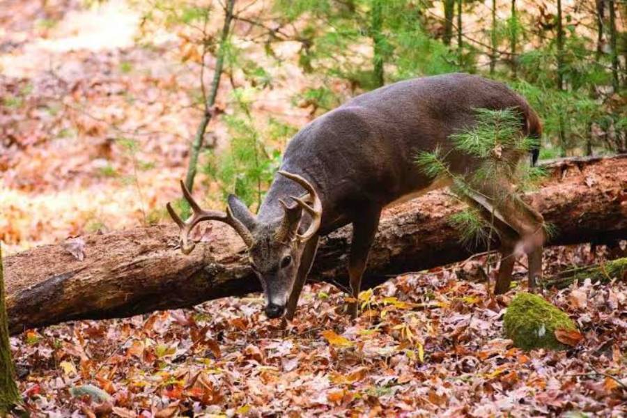
Buck staging areas are transition locations that bucks use between secure bedding cover and primary destinations, such as feeding areas. To find buck staging areas, identify likely bedding cover and food sources first, trace the secure travel routes connecting them, and then narrow the search using terrain, thick cover, concentrated trails, rubs, scrapes, and tracks. A productive staging area is not simply any piece of cover between a bed and a food source. Its location and surrounding sign should indicate that bucks consistently use the area before continuing toward their destination.
The most reliable scouting process combines map analysis with field verification. Topographic and satellite maps help identify bedding cover, food sources, ridges, benches, saddles, funnels, habitat transitions, and other features that can influence buck movement. Field scouting then determines whether those predicted locations contain the trails and buck-specific sign needed to support the initial assessment.
Staging areas also change in value throughout the hunting season. Food availability, wind direction, thermals, hunting pressure, and seasonal changes in buck behavior can alter when and how a location is used. This guide explains how to move from identifying potential staging areas on a map to confirming them in the field without relying on a single sign or terrain feature.
What Is a Buck Staging Area?
A buck staging area is a secure transition location where a buck spends time after leaving its bedding area and before moving toward a primary destination, such as an agricultural field, mast-producing timber, or another feeding area. These locations are commonly associated with cover and travel routes that allow a buck to remain concealed before entering more exposed habitat.
The key characteristic of a staging area is its position within a buck’s movement pattern. A useful way to evaluate this relationship is bedding area → travel route → staging area → primary destination. The staging area serves a different function from the destination itself. A buck may reach the staging area while daylight remains and continue toward an exposed food source later, which makes identifying the transition location important when analyzing evening movement.
A patch of thick cover between bedding and food should not automatically be classified as a staging area. The location needs supporting evidence of repeated use. Concentrated trails, tracks, rubs, scrapes, or repeated observations of buck movement can strengthen the identification. The surrounding terrain and cover should also make sense as part of a secure route from bedding cover toward the destination.
What Is the Difference Between a Buck Staging Area and a Bedding Area?
A bedding area is where a buck beds and spends extended periods resting, while a staging area is a transition location used between the bedding area and another destination. The difference is primarily based on function and movement rather than vegetation type alone.
Bedding areas provide security for extended periods and are commonly selected where cover, visibility, terrain, and wind conditions help a buck detect danger. A staging area serves a shorter transitional function. Bucks move into it after leaving their beds, remain within relatively secure cover, and then continue along their travel route.
Field evidence can help distinguish the two. Beds or repeated bedding evidence indicate that the location may function as a bedding area. Trails and buck sign concentrated along a route toward a food source can instead support staging-area use. Hunters should evaluate the complete movement relationship rather than classifying a location from one rub, scrape, bed, or trail.
Where Are Buck Staging Areas Usually Located?
Buck staging areas are usually located along secure travel routes between bedding cover and primary destinations, with suitable cover allowing bucks to delay entering more exposed areas. The most promising locations therefore occur where three elements intersect: proximity to bedding, a logical route toward a destination, and enough security cover to support daylight movement.
A common example is thick cover positioned between a bedding area and an agricultural field. Instead of moving directly from secure bedding cover into the open field, a buck can travel into the covered transition area first. Similar relationships can occur around young timber, brush, overgrown vegetation, field edges, and habitat transitions when those features connect bedding cover with a destination.
Distance from bedding should not be treated as a fixed measurement. The functional relationship between the locations is more useful than an arbitrary number of yards. Terrain, vegetation density, human access, hunting pressure, and the distance to the destination can change where a buck feels secure enough to stage. On one property, useful staging cover may occur relatively close to the bed; on another, the strongest location may occur farther along the travel route.
Security cover is especially important because it helps explain why a buck would use one section of a travel route rather than another. Thick vegetation, brushy edges, young timber, and abrupt habitat transitions can provide visual concealment while still allowing movement toward food. When this cover occurs on a logical bedding-to-food route and contains concentrated buck sign, it becomes a stronger staging-area candidate.
Hunters should therefore avoid searching for staging areas as isolated habitat features. Start with the two larger destinations—where the buck is likely bedding and where it is likely going—and analyze the secure space connecting them. This approach reduces the amount of ground that needs to be searched and provides context for interpreting the sign found during field scouting.
What Terrain Features Help You Find Buck Staging Areas?
The most useful terrain features for finding buck staging areas are features that concentrate, redirect, or provide secure movement between bedding cover and a primary destination. Benches, ridges, saddles, terrain funnels, habitat edges, and transition zones are valuable because they can narrow the number of practical routes a buck uses. The terrain feature alone does not create a staging area; it becomes relevant when it connects bedding, security cover, and a destination.
Benches can provide relatively easy travel across otherwise steep terrain. A bench located below or near secure bedding cover may create a logical route toward lower-elevation feeding areas. Ridges can serve a similar function when their shape allows bucks to move through continuous cover instead of dropping directly into exposed terrain. Hunters should examine where these features intersect thicker vegetation or a change in habitat because that combination can create a stronger staging-area candidate.
Saddles and terrain funnels are useful because they reduce the number of efficient routes through an area. A saddle creates a lower crossing point between higher terrain, while a funnel constricts movement through features such as steep slopes, water, open ground, or changes in cover. A funnel becomes especially relevant to staging-area scouting when it concentrates a bedding-to-food travel route before the buck reaches its final destination. Concentrated trails or buck sign near the covered side of that constriction provide stronger evidence than the terrain feature by itself.
Habitat transitions can also help locate staging areas. Examples include mature timber meeting young regeneration, thick brush meeting more open woods, or wooded cover meeting an agricultural field. These transitions provide both identifiable travel structure and changes in security cover. A transition located immediately beside a food source may function primarily as an entry route, while one positioned farther back toward bedding cover may provide the security associated with staging behavior. The surrounding movement pattern determines its function.
For this reason, terrain should be used as a filtering system rather than proof. First determine where a buck is likely coming from and where it is likely going, then identify the terrain features that provide the most secure and efficient connection between those locations. This process produces a small number of staging-area candidates that can later be checked for physical sign.
How Can You Find Buck Staging Areas on a Map?
To find buck staging areas on a map, identify likely bedding cover and primary destinations first, trace secure travel routes between them, and then mark locations where terrain and cover could cause bucks to pause before continuing. Satellite imagery is useful for evaluating vegetation, fields, habitat edges, and cover changes, while topographic maps help reveal ridges, benches, saddles, drainages, and other terrain features that can influence travel.
Start by locating likely bedding habitat. Look for areas that offer security and separation from regular human activity rather than simply marking every patch of woods. Thick vegetation, isolated cover, terrain that restricts easy access, and locations away from roads or frequently used trails can provide initial areas to investigate. These are predictions from map information, so they still require field evidence before being treated as confirmed buck bedding.
Next, identify likely destinations. Food sources are especially useful for establishing the opposite end of a potential evening travel pattern. Depending on the property and season, these destinations can include agricultural fields, mast-producing timber, or other concentrated food sources. The objective is not to map every possible place a deer could feed. Identify the destinations most likely to generate consistent movement from the bedding cover being evaluated.
How Do You Trace Likely Travel Routes Between Bedding and Food?
Trace likely buck travel routes by following the most secure and terrain-efficient connections between probable bedding cover and the selected food source. Bucks do not have to travel along the shortest straight line. Cover, terrain, wind, human disturbance, and physical barriers can make an indirect route more practical than a direct one.
Begin at the suspected bedding area and work toward the destination on the map. Follow continuous cover and note features such as benches, ridge systems, saddles, narrow strips of timber, creek corridors, and habitat transitions that could channel movement. Pay particular attention to locations where several favorable features overlap. For example, a bench connecting thick bedding cover with a wooded field edge provides more contextual evidence than an isolated bench with no clear relationship to bedding or food.
Next, look for a location along the route where the buck can remain concealed before reaching more exposed habitat. This is a potential staging area. A thick transition 100 yards from a field, for example, is not automatically better than one 300 yards away. Its value depends on whether the route, security cover, terrain, and subsequent field evidence indicate that bucks actually use it as part of their movement sequence.
Mark several candidates instead of selecting one location from aerial imagery alone. Rank each candidate according to its relationship with bedding, destination, security cover, terrain, and likely human pressure. The map should narrow the search; physical buck sign should confirm it. Once several locations have been identified, field scouting can determine which candidate contains the trails, tracks, rubs, scrapes, or other evidence consistent with repeated buck use.
What Buck Sign Confirms a Staging Area?
The strongest buck sign for confirming a staging area is a combination of concentrated trails, tracks, rubs, and scrapes positioned on a logical travel route between bedding cover and a primary destination. One isolated rub, scrape, or track does not confirm a staging area. The sign becomes more meaningful when several types occur together in secure cover and support the bedding-to-destination movement pattern identified during map scouting.
Start with deer trails because they reveal where repeated movement occurs. A well-used trail running from suspected bedding cover toward a food source establishes a potential travel corridor. Multiple trails converging inside thick cover can be particularly useful because they indicate that movement is becoming concentrated. The next step is determining whether bucks, rather than deer in general, are consistently using that location.
Tracks provide another layer of evidence. Fresh tracks can confirm recent movement and show the direction deer are traveling through the area. Repeated tracks combined with a defined trail are more useful than a single track because staging areas are identified through patterns of use. Compare track evidence with the direction of suspected bedding and feeding locations to determine whether the movement makes sense within the larger travel pattern.
Rubs can strengthen the case for buck activity. Look beyond a single rubbed tree and examine how rubs are distributed through the travel corridor. Several rubs associated with trails and secure cover provide more context than one conspicuous rub beside an unrelated trail. Their value comes from their relationship with the surrounding movement pattern.
Scrapes should be interpreted in the same way. A scrape located within covered travel habitat becomes more relevant when trails, tracks, or rubs occur nearby. The objective is not simply to find the greatest amount of sign. The objective is to find concentrated buck sign in the correct location and context.
For example, consider a thick transition between a suspected bedding ridge and an agricultural field. A hunter finds two converging trails in the transition, several rubs along one trail, tracks traveling toward the field, and a scrape within the same covered area. That combination provides substantially stronger evidence of a staging area than finding one large rub near the field edge.
How Do You Confirm a Buck Staging Area in the Field?
Confirm a buck staging area in the field by verifying five elements: its relationship to bedding, its relationship to a destination, security cover, concentrated travel, and repeated buck-specific sign. These elements test whether the location actually functions as part of a buck’s movement pattern rather than merely looking promising on a map.
Begin with the location itself. Determine whether the candidate sits on a logical route from probable bedding cover toward a food source or another destination. Then evaluate the surrounding vegetation and terrain. The area should provide a reason for a buck to use that particular section of the route, such as thicker cover, a terrain transition, a bench, a funnel, or another feature that supports secure movement.
Next, inspect travel evidence. Identify the main trails entering and leaving the candidate area and determine where they lead. Trails that connect back toward bedding and forward toward a destination fit the staging-area model better than trails with no obvious relationship to either. Tracks can add information about recent use and direction of travel.
Then evaluate buck-specific sign. Rubs and scrapes should be interpreted together with the trail network instead of as independent discoveries. A cluster of relevant sign along a covered travel corridor increases confidence that bucks repeatedly use the location. When the terrain, cover, trails, and buck sign all support the same movement pattern, the candidate becomes much stronger.
Trail cameras can provide an additional method of verification by showing which deer use the route, when they pass through, and which direction they travel. Repeated buck activity moving from the bedding side toward the destination side can support the field evidence. Camera information is most useful when interpreted with the physical layout rather than treated as proof that every location producing buck photos is a staging area.
How Can You Scout a Staging Area Without Disturbing Bucks?
Scout a potential staging area with the least intrusion necessary to verify its location, travel routes, and buck sign. Excessive movement through secure cover can introduce human scent and disturbance into the same habitat being evaluated, making later observations less representative of normal buck movement.
Plan the access route before entering the area. Avoid crossing the primary trails you are trying to evaluate when another approach is available, and account for wind direction so human scent is not carried toward suspected bedding cover. Entering directly through bedding habitat simply to reach a staging candidate creates unnecessary disturbance and can affect the movement pattern the scouting trip is intended to study.
Focus the field check on information that cannot be established from the map. Confirm cover type, terrain structure, trail direction, tracks, rubs, scrapes, and the relationship between the candidate and surrounding habitat. Once those elements provide enough evidence to evaluate the location, additional intrusion produces diminishing value.
A low-impact approach also means recognizing when observation can replace additional walking. Trail-camera information or observations from a less intrusive location can help establish movement timing after the physical layout has been identified. The goal is to collect enough evidence to confirm the staging area without changing the buck behavior that made the location valuable in the first place.
How Do Wind Direction and Thermals Affect Buck Staging Areas?
Wind direction and thermals affect which travel routes bucks use to enter, move through, and leave a staging area. A staging location can contain suitable cover, terrain, and buck sign but still produce different movement patterns under different wind conditions. Hunters should therefore evaluate not only where a staging area is located but also how scent moves through the surrounding terrain.
Bucks can use wind conditions to gather scent information while remaining in secure cover. This can influence which side of a travel corridor receives the most activity and which trail a buck selects on a particular day. A staging area with several parallel or converging trails may therefore show uneven use as wind direction changes. Identifying these alternative routes helps explain why a buck can continue using the same general staging area without following exactly the same trail every time.
Thermals add another variable in terrain where temperature differences cause air to move vertically. As air temperatures change, scent movement can change with them. This makes terrain position important when evaluating staging areas around slopes, ridges, benches, and drainages. Hunters should consider both prevailing wind and local air movement instead of assuming that a single wind forecast describes scent behavior throughout the entire location.
Wind also affects how a hunter should approach a suspected staging area. An access route that carries human scent toward bedding cover or across the primary travel corridor can disturb the movement being evaluated. A useful staging area should therefore be assessed together with a low-impact access route and favorable wind conditions. This preserves the security characteristics that encourage bucks to use the location.
When Do Bucks Use Staging Areas During the Hunting Season?
Bucks can use staging areas throughout the hunting season, but the importance and location of these areas change as food sources, breeding behavior, security needs, and hunting pressure change. A staging area identified during one part of the season should not automatically be expected to produce the same movement later in the year.
During the early season, bedding-to-food relationships can provide a strong starting point for locating staging areas. When bucks follow relatively consistent movement toward concentrated food sources, covered locations along those routes can receive repeated use. Hunters can begin with known or suspected bedding cover, identify the current food source, and examine the secure travel corridor connecting the two.
The pre-rut and rut can change these patterns because buck movement priorities shift. Bucks may travel more extensively and use routes associated with doe activity, scrapes, and broader movement rather than following the same direct bedding-to-food pattern every evening. A staging area can remain active, but the amount, timing, or type of buck traffic through it may change. Fresh sign and current observations become more important than relying entirely on evidence collected earlier in the season.
Late-season staging areas become closely connected to the combination of security and available food. After sustained hunting pressure, bucks that remain in an area have additional reasons to favor secure cover and lower-risk travel. Food sources can also change from those used earlier in the year. Hunters should reassess both ends of the original movement relationship because a different bedding location or destination can create a different staging route.
How Do Staging Areas Change From Early Season to the Rut and Late Season?
Staging areas change when the destinations and movement priorities of bucks change. During the early season, a productive location may be strongly associated with a predictable bedding-to-food route. During the pre-rut and rut, increased movement and breeding-related behavior can reduce the consistency of that simple pattern. During the late season, security and remaining food sources can again concentrate movement, but not necessarily in the same locations used earlier.
The practical consequence is that old sign should not receive the same weight as current evidence. Rubs, scrapes, tracks, trails, observations, and trail-camera activity should be evaluated according to when they were produced. A staging area covered with sign from an earlier phase of the season may look impressive while receiving little current use.
Hunters can reassess a staging area by repeating the same relationship used to find it initially: identify current bedding cover, identify the current destination, trace the secure routes connecting them, and check those routes for fresh buck activity. This keeps staging-area scouting tied to current movement instead of assuming that a location remains productive simply because bucks used it previously.
Read more: How to Hunt Leeward Ridges for Whitetails
How Does Hunting Pressure Change Buck Staging Areas?
Hunting pressure can change when bucks use a staging area, which routes they take to reach it, and whether they continue using the location during daylight. Repeated human activity around bedding cover, travel corridors, field edges, and access routes can make an otherwise productive staging area less secure. For this reason, a staging area identified before or early in the season should be reassessed after hunting pressure increases.
One of the first changes to examine is movement timing. A staging area may continue receiving buck activity even when daylight use decreases. Tracks, rubs, scrapes, or trail-camera activity can show that bucks still pass through the location, but the timing of that activity determines whether the original movement pattern remains relevant. This distinction prevents hunters from abandoning a location simply because visible daylight activity declines.
Travel routes can also shift while the general bedding-to-destination relationship remains intact. A buck may use thicker cover, a parallel trail, a different side of a terrain feature, or another concealed approach to the same destination. When activity disappears from a previously productive trail, inspect nearby secure routes before concluding that the entire staging area has been abandoned.
Access pressure deserves particular attention because the route used to enter an area can interfere with the same movement pattern a hunter is trying to identify. Crossing major deer trails, approaching too close to bedding cover, or repeatedly moving through staging cover introduces disturbance into high-value security habitat. A location with excellent terrain and sign can lose practical value when reaching it consistently requires disturbing the surrounding movement corridor.
The correct response to hunting pressure is therefore to reassess current movement rather than relying on historical sign. Compare fresh tracks, trails, rubs, scrapes, observations, and trail-camera activity with the original staging-area pattern. If current evidence shifts to nearby security cover, update the predicted travel route and staging location accordingly.
What Is the Step-by-Step Process for Finding a Buck Staging Area?
Finding a buck staging area requires eight steps: identify bedding cover, identify the destination, trace secure travel routes, narrow those routes with terrain and cover, locate potential staging cover, check buck sign, verify current movement, and reassess the location for changing conditions. Following this sequence prevents a common scouting error: finding attractive sign first and assuming the surrounding location must be a staging area.
1. Identify likely buck bedding cover. Start with the location from which the buck is likely beginning its movement. Use satellite imagery, topographic features, security cover, terrain, and human-access patterns to identify probable bedding habitat. Treat mapped bedding areas as hypotheses until field evidence supports them.
2. Identify the primary destination. Determine where the buck is likely traveling after leaving its bedding area. Agricultural fields, mast-producing timber, and other concentrated food sources are examples of destinations that can establish the opposite end of the movement pattern. Use food sources that are relevant to the current season rather than assuming one destination remains equally important throughout the year.
3. Trace secure travel routes. Follow the logical connections between bedding and the destination. Prioritize routes that combine security cover with efficient terrain. Bucks do not need to follow the shortest straight-line route, so examine benches, ridges, saddles, funnels, habitat transitions, creek corridors, and continuous strips of cover that provide alternative movement paths.
4. Narrow the routes using terrain and cover. Reduce several possible travel corridors to the locations where movement is most likely to concentrate. A terrain funnel, covered bench, narrow strip of timber, or abrupt transition in vegetation can make one section of the route more significant than surrounding habitat. The strongest candidates combine a logical terrain feature with security cover.
5. Locate potential staging cover. Search the narrowed travel corridor for secure locations positioned before the primary destination. The area should provide a reason for a buck to remain concealed instead of immediately continuing into exposed habitat. Thick brush, young timber, covered transitions, and similar security features become stronger candidates when they sit on the correct bedding-to-destination route.
6. Check trails, tracks, rubs, and scrapes. Use physical sign to test the prediction made from maps, terrain, and cover. Concentrated trails establish repeated movement, tracks provide evidence of recent travel, and rubs or scrapes can strengthen evidence of buck activity. Several related signs in the correct context provide stronger confirmation than one isolated rub or scrape.
7. Verify buck presence and movement timing. Determine whether bucks are currently using the candidate and how they move through it. Field observations and trail-camera information can help establish direction of travel and timing. Repeated movement from the bedding side toward the destination side provides stronger support for staging behavior than occasional buck presence without a consistent travel pattern.
8. Reassess wind, season, and hunting pressure. Treat staging areas as parts of a changing movement system rather than permanent points on a map. Wind can alter route selection, seasonal changes can shift destinations, and hunting pressure can reduce daylight activity or push movement into adjacent cover. Fresh evidence should take priority over sign collected weeks or months earlier.
The complete process can be summarized as bedding → route → staging cover → destination → verification. Each part provides context for the next. Bedding and food establish the movement relationship, terrain and cover narrow the search, buck sign tests the prediction, and current observations verify whether the location is still being used.
A productive buck staging area is therefore identified through multiple layers of evidence rather than one terrain feature or one piece of sign. The strongest staging-area candidate combines a logical position between bedding and a destination, secure cover, concentrated travel, buck-specific sign, and current evidence of use. When all five elements support the same movement pattern, the hunter has substantially more information than a scouting strategy based only on finding rubs, scrapes, or heavily used trails.